![Alberto Beingolea: “If they insist on not giving [the powers], they are complicating life for Peru”](https://insightermedia.com/wp-content/uploads/2026/09/bb3fa9e11304ea13fe2cd333955007bc-150x150.webp "Alberto Beingolea: “If they insist on not giving [the powers], they are complicating life for Peru”")



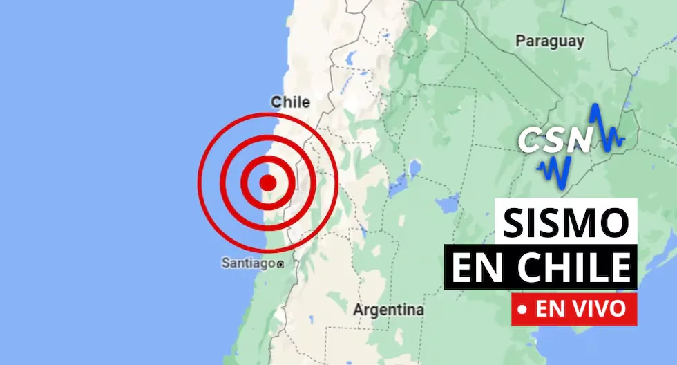
Earthquakes in Chile via the CSN
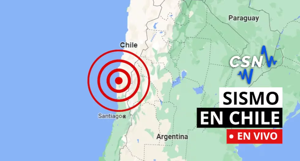
Follow live reports of earthquakes in Chile, according to the National Seismological Center (CSN). You can also check related news, as well as recommendations for these types of situations.
Read more Dollar price in Peru, Friday, August 21: what was the exchange rate closing today
- How much should the survival backpack weigh?
The ideal weight should not exceed 25% of the body weight of the person carrying it, ensuring a quick and agile evacuation.
- Can an earthquake be predicted?
Currently, it is impossible to determine, as the Earth itself presents a wide dynamic regarding its movements, considering that it is not only about predicting when it will shake, but also being able to determine the intensity, magnitude, depth, and other important factors.
- Earthquake 147 km E of San Pedro de Atacama
Local Time: 20:03:40 21/08/2026
UTC Time: 00:03:40 22/08/2026
Latitude: -22.59
Longitude: -66.82
Depth: 294 km
Magnitude: 4.2 MLv
- Earthquake 7 km NW of Camiña
Local Time: 20:01:58 21/08/2026
UTC Time: 00:01:58 22/08/2026
Latitude: -19.26
Longitude: -69.46
Depth: 70 km
Magnitude: 3.2 MLv
- Earthquake 72 km SE of Socaire
Local Time: 19:09:33 21/08/2026
UTC Time: 23:09:33 21/08/2026
Latitude: -23.95
Longitude: -67.30
Depth: 233 km
Magnitude: 3.0 MLv
- Earthquake 34 km SE of Mina La Escondida
Local Time: 18:51:01 21/08/2026
UTC Time: 22:51:01 21/08/2026
Latitude: -24.53
Longitude: -68.89
Depth: 111 km
Magnitude: 3.7 MLv
- Earthquake 107 km NE of El Salvador
Local Time: 18:26:02 21/08/2026
UTC Time: 22:26:02 21/08/2026
Latitude: -25.51
Longitude: -68.94
Depth: 118 km
Magnitude: 4.6 Mw
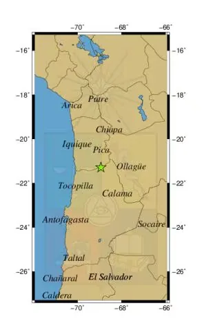
- Earthquake 59 km SW of Mina Collahuasi
Local Time: 16:40:08 21/08/2026
UTC Time: 20:40:08 21/08/2026
Latitude: -21.29
Longitude: -68.94
Depth: 120 km
Magnitude: 2.8 MLv
Geographical reference of the earthquake 59 km SW of Mina Collahuasi.
- Earthquake 43 km W of Quintero
Local Time: 16:26:38 21/08/2026
UTC Time: 20:26:38 21/08/2026
Latitude: -32.76
Longitude: -71.98
Depth: 24 km
Magnitude: 4.0 MLv
- Earthquake 36 km S of Mina Collahuasi
Local Time: 16:19:19 21/08/2026
UTC Time: 20:19:19 21/08/2026
Latitude: -21.14
Longitude: -68.74
Depth: 120 km
Magnitude: 2.7 MLv
- Earthquake 51 km N of Tocopilla
Local Time: 15:49:05 21/08/2026
UTC Time: 19:49:05 21/08/2026
Latitude: -21.65
Longitude: -70.06
Depth: 44 km
Magnitude: 3.3 MLv
- Earthquake 38 km E of Mina Los Pelambres
Local Time: 15:47:04 21/08/2026
UTC Time: 19:47:04 21/08/2026
Latitude: -31.77
Longitude: -70.19
Depth: 139 km
Magnitude :2.6 MLv
How do you know it will shake?
Earthquakes cannot be predicted, but seismographs and accelerographs detect ground movements in real time to alert us as quickly as possible.
- Earthquake 71 km SE of Socaire
Local Time: 15:40:57 21/08/2026
UTC Time: 19:40:57 21/08/2026
Latitude: -24.06
Longitude: -67.42
Depth: 187 km
Magnitude: 3.0 MLv
Earthquake 70 km SE of Socaire
Local Time: 14:01:45 21/08/2026
UTC Time: 18:01:45 21/08/2026
Latitude: -23.95
Longitude: -67.32
Depth: 232 km
Magnitude: 3.4 MLv
Earthquake 15 km SW of Punitaqui
Local Time: 12:14:57 21/08/2026
UTC Time: 16:14:57 21/08/2026
Latitude: -30.93
Longitude: -71.38
Depth: 56 km
Magnitude: 3.1 MLv
Earthquake 26 km E of Ollagüe
Local Time: 12:04:22 21/08/2026
UTC Time: 16:04:22 21/08/2026
Latitude: -21.28
Longitude: -68.01
Depth: 206 km
Magnitude: 2.9 MLv
Earthquake 12 km SW of San Pedro de Atacama
Local Time: 11:51:23 21/08/2026
UTC Time: 15:51:23 21/08/2026
Latitude: -22.99
Longitude: -68.28
Depth: 137 km
Magnitude: 3.6 MLv
Earthquake 31 km NW of Quintero
Local Time: 11:20:16 21/08/2026
UTC Time: 15:20:16 21/08/2026
Latitude: -32.63
Longitude: -71.81
Depth: 26 km
Magnitude: 2.6 MLv
Earthquake 69 km W of San Antonio de los Cobres
Local Time: 08:52:38 21/08/2026
UTC Time: 12:52:38 21/08/2026
Latitude: -24.06
Longitude: -66.98
Depth: 222 km
Magnitude: 3.4 MLv
Earthquake 41 km E of Paposo
Local Time: 08:15:29 21/08/2026
UTC Time: 12:15:29 21/08/2026
Latitude: -24.91
Longitude: -70.08
Depth: 55 km
Magnitude: 2.5 MLv
How to know if an earthquake is strong?
There are two ways:
– Magnitude, measured on the Richter scale, indicates the energy released.
– Intensity, measured on the Mercalli scale, measures the impact on people and structures.
What to do after an earthquake?
Check for injuries, turn off gas and electricity leaks, avoid using the elevator, and stay away from damaged structures. If you are in a coastal area, check for tsunami alerts.
Why does the Earth shake?
Because tectonic plates move and accumulate energy. When this energy is released suddenly, an earthquake occurs.
What should my emergency backpack have?
It should contain the essentials to survive the first hours after an earthquake:
– Hygiene items
– First aid kit with bandages, alcohol, gauze, pills, among others
– Warm clothing
– Non-perishable food such as tuna, energy bars, chocolates, and nuts, as well as cash
– Radio or flashlight with batteries
– Specific items according to needs, such as products for babies, elderly, or pets
How to prepare before an earthquake?
Conduct drills, have your emergency backpack ready, and plan an evacuation route with your family. Prevention saves lives.
What is the difference between earthquake, tremor, seismic event, and tectonic movement?
They are synonyms, but in some countries “earthquake” is used for the most destructive seismic events.
What to do before an earthquake
• Have your emergency backpack ready.
• Identify safe zones at home, work, and on the street.
• Participate in drills.
What to do during an earthquake
• Stay calm.
• Protect yourself under a sturdy table or in the triangle of life.
• Stay away from windows and objects that may fall.
What to do after an earthquake
• Assess damage and check for injuries.
• Use text messages to communicate and avoid overloading phone lines.
• Stay away from damaged buildings and follow authorities’ instructions.
- WHAT IS THE LARGEST MAGNITUDE EARTHQUAKE RECORDED IN CHILE?
The earthquake on May 22, 1960, recorded in Valdivia with a magnitude of 9.5 is the strongest earthquake recorded in the country.
- WHAT IS THE PACIFIC RING OF FIRE?
The Pacific Ring of Fire is a geologically active region that surrounds the Pacific Ocean and the continents bordering its waters. It is characterized by a high frequency of earthquakes and volcanic activity. It extends approximately 40,000 kilometers, including subduction zones where tectonic plates collide (such as the Nazca plate), generating frequent volcanoes and earthquakes.
- WHAT IS SEISMIC SILENCE?
Seismic silence is a prolonged period without significant seismic activity or intensity in a region, which may indicate the accumulation of tectonic stresses and an increased risk of a future earthquake.
- WHY IS CHILE A HIGHLY SEISMIC COUNTRY?
Chile is located on the western edge of the South American plate, where the Nazca and Antarctic plates converge and generate earthquakes. This is one of the zones of the Ring of Fire.
- WHAT IS THE DIFFERENCE BETWEEN MAGNITUDE AND INTENSITY OF AN EARTHQUAKE?
They are scales to measure the size or impact of a tremor. The magnitude scale is obtained numerically from records obtained by seismographs and is related to the size and energy released during a tremor. The intensity scale is assigned based on the damage or effects caused to people and their constructions.
- WHAT TO DO IN CASE OF A TSUNAMI?
If you receive official tsunami alert or alarm information or see the sea receding, evacuate to higher areas. Move to a flood-free zone and head to the nearest meeting point. If you cannot reach a higher area, go to an upper floor or the roof of a solid building.
Read more Pope Leo XIV changes his visit dates to Peru and will now stay one day less in the country
- Follow live reports of the latest earthquakes in Chile recorded by the National Seismological Center. Also check related news and recommendations to act in these types of situations.