![Alberto Beingolea: “If they insist on not giving [the powers], they are complicating life for Peru”](https://insightermedia.com/wp-content/uploads/2026/09/bb3fa9e11304ea13fe2cd333955007bc-150x150.webp "Alberto Beingolea: “If they insist on not giving [the powers], they are complicating life for Peru”")



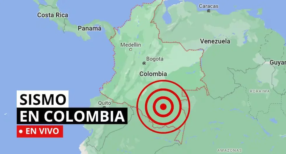
Earthquake in Colombia via the Geological Service
The SGC has a total of 339 seismic stations, located throughout the Colombian territory and in specific areas such as active volcanoes. 206 seismic stations are located covering the entire territory corresponding to the National Seismic Network and 133 seismic stations installed on the active Colombian volcanoes that are permanently monitored in three volcanological and seismological observatories.
Read more Do you need a job? Here’s how you can download the MTPE Unique Labor Certificate for free
Find out here about the earthquakes that have occurred in Colombian territory, reported by the Geological Service. Here we tell you which were the latest.
- These are the municipalities with the highest record of tremors in Colombia
- Los Santos – Santander
- Zapatoca – Santander
- Villanueva – Santander
- Jordán – Santander
- Dabeiba – Antioquia
- Uribe – Meta
- Mesetas – Meta
- Caribbean Sea
- El Carmen – Santander
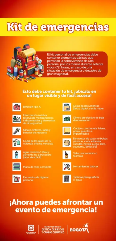
- A well-prepared emergency kit can make a difference. Place it in a visible location with quick access.
- Earthquake in Calima (El Darién) – Valle del Cauca, Colombia
- Magnitude: 3.2
- Depth: 106 km
- Local time: 2026-08-04 11:25:51
- UTC time: 2026-08-04 16:25:51
- Latitude: 3.93°
- Longitude:-76.72°
- Has seismic activity increased worldwide in recent years? In Colombia?
- Generally, seismic activity worldwide and in Colombia has not had a considerable increase; what happens is that humans have populated new areas of the planet, which were previously uninhabited, and because of this, more is now heard about earthquakes, explains the National Seismic Network of Colombia-RSNC.
- Earthquake in Magüí (Payán) – Nariño, Colombia
- Magnitude: 3.3
- Depth: 84 km
- Local time: 2026-08-04 07:52:53
- UTC time: 2026-08-04 12:52:53
- Latitude: 1.90°
- Longitude:-78.25°
- Earthquake in Dabeiba – Antioquia, Colombia
- Magnitude: 2.3
- Depth: Shallow (Less than 30 km)
- Local time: 2026-08-04 07:52:07
- UTC time: 2026-08-04 12:52:07
- Latitude: 7.14°
- Longitude:-76.31°
- Earthquake in Frontino – Antioquia, Colombia
- Magnitude: 2
- Depth: Shallow (Less than 30 km)
- Local time: 2026-08-04 07:52:03
- UTC time: 2026-08-04 12:52:03
- Latitude: 6.82°
- Longitude:-76.20°
- HOW MANY EARTHQUAKES OCCUR ON AVERAGE PER MONTH IN COLOMBIA?
There are 2,500 earthquakes per month, but most are not of significant magnitude or intensity. “
- WHERE IN COLOMBIA DO MOST EARTHQUAKES OCCUR?
The most seismically active places in the country are the coasts and around our mountain ranges.
- Earthquake in Carmen del Darién
- Date and Local Time: 2026-08-03 18:03
- Magnitude: 2.2
- Depth: 33 km
- Latitude: 6.92
- Longitude: -76.94
- WHY ARE THERE SO MANY EARTHQUAKES IN COLOMBIA?
Colombia is located in the northwestern corner of South America, where the South American, Nazca, and Caribbean tectonic plates converge; a characteristic that explains the high level of seismicity in the country.
- Earthquake in Pensilvania – Caldas
- Date and Local Time: 2026-08-03 16:38
- Magnitude: 2.3
- Depth: 88 km
- Latitude: 5.41
- Longitude: -75.13
- Earthquake in Dabeiba – Antioquia
- Date and Local Time: 2026-08-03 15:48
- Magnitude: 2.1
- Depth: shallow
- Latitude: 6.98
- Longitude: -76.33
- Earthquake in Los Santos – Santander, Colombia
Magnitude: 2.4
Depth: 140 km
Local time: 2026-08-03 13:06:39
UTC time: 2026-08-03 18:06:39
Latitude: 6.77°
Longitude: -73.11°
- Earthquake in Santa Helena del Opón – Santander, Colombia
Magnitude: 2.2
Depth: 108 km
Local time: 2026-08-03 11:24:57
UTC time: 2026-08-03 16:24:57
Latitude: 6.38°
Longitude: -73.65°
- Earthquake in Los Santos – Santander, Colombia
Magnitude: 2.6
Depth: 146 km
Local time: 2026-08-03 13:46:00
UTC time: 2026-08-03 18:46:00
Latitude: 6.82°
Longitude: -73.06°
- Earthquake in Piedecuesta – Santander, Colombia
Magnitude: 2.3
Depth: 155 km
Local time: 2026-08-03 13:06:38
UTC time: 2026-08-03 18:06:38
Latitude: 6.81°
Longitude: -72.97°
- WHAT IS A SEISMIC SWARM?
A seismic swarm is a group of earthquakes that occur in the same area over a short period of time. Unlike a single strong earthquake, seismic swarms usually consist of numerous smaller tremors. Often, there is no main earthquake triggering the swarm, but the seismic events occur more or less continuously and are related to tectonic processes.
- Earthquake in Santa Helena del Opón – Santander, Colombia
Magnitude: 2.1
Depth: 109 km
Local time: 2026-08-03 11:24:57
UTC time: 2026-08-03 16:24:57
Latitude: 6.40°
Longitude: -73.64°
- Earthquake in Venezuela – Colombia, Border Region
Magnitude: 2.7
Depth: 103 km
Local time: 2026-08-03 10:48:19
UTC time: 2026-08-03 15:48:19
Latitude: 11.05°
Longitude: -72.28°
- Earthquake in Tamalameque – Cesar, Colombia
Magnitude: 2.6
Depth: 86 km
Local time: 2026-08-03 08:52:34
UTC time: 2026-08-03 13:52:34
Latitude: 8.82°
Longitude: -73.76°
- Earthquake in Murillo – Tolima, Colombia
Magnitude: 2.2
Depth: Shallow (Less than 30 km)
Local time: 2026-08-03 06:41:10
UTC time: 2026-08-03 11:41:10
Latitude: 4.79°
Longitude: -75.17°
- Earthquake in Plato – Magdalena, Colombia
Magnitude: 3.8
Depth: 37 km
Local time: 2026-08-03 06:27:04
UTC time: 2026-08-03 11:27:04
Latitude: 9.95°
Longitude: -74.51°
- Earthquake in Los Santos – Santander, Colombia
Magnitude: 2.3
Depth: 143 km
Local time: 2026-08-03 03:20:06
UTC time: 2026-08-03 08:20:06
Latitude: 6.80°
Longitude: -73.16°
- Earthquake in Los Santos – Santander, Colombia
Magnitude: 2.7
Depth: 143 km
Local time: 2026-08-03 03:01:04
UTC time: 2026-08-03 08:01:04
Latitude: 6.79°
Longitude: -73.14°
- WHY DOES IT SHAKE SO FREQUENTLY IN COLOMBIA?
Colombia is a country of high seismic activity due to its complex geological location. The national territory is situated at the convergence of three large dynamic structures: the Nazca Plate, the South American Plate, and the Caribbean Plate. The constant subduction process, in which the Nazca Plate is pushed beneath the South American Plate, generates a continuous state of deformation and energy accumulation in the Earth’s crust.
- WHAT IS AN EARTHQUAKE?
An earthquake is a sudden breaking of rocks inside the Earth. This sudden release of energy propagates in the form of waves that cause ground movement.
Read more Everything you need to know about the wedding of Cristiano Ronaldo and Georgina Rodríguez
- WHAT IS THE DIFFERENCE BETWEEN MAGNITUDE AND INTENSITY OF AN EARTHQUAKE?
They are scales to measure the size or impact of a tremor. The magnitude scale is obtained numerically from records obtained by seismographs and is related to the size and energy released during a tremor. The intensity scale is assigned based on the damage or effects caused to people and their constructions.
- WHAT IS THE DIFFERENCE BETWEEN EARTHQUAKE, TREMOR, SEISM, AND TELURIC MOVEMENT?
Actually, the four terms are synonyms, but in Latin America special emphasis has been given to the term earthquake to refer to destructive quakes or those that have caused casualties.
- HOW MANY SEISMOGRAPHS ARE THERE?
- NATIONAL SEISMIC NETWORK OF COLOMBIA-RSNC
The SGC has a total of 339 seismic stations, located throughout the Colombian territory and in specific areas such as active volcanoes. 206 seismic stations are located covering the entire territory corresponding to the National Seismic Network.
There are 133 seismic stations installed on the active Colombian volcanoes that are permanently monitored in three volcanological and seismological observatories.
- WHAT IS THE COLOMBIAN GEOLOGICAL SERVICE?
The SGC is a century-old science and technology entity attached to the Ministry of Mines and Energy, whose objective is to contribute to the country’s economic and social development through research in basic and applied geosciences of the subsurface, the potential of its resources, the evaluation and monitoring of geological hazards, the comprehensive management of geoscientific knowledge, research and nuclear and radioactive control, attending to the priorities of the National Government’s policies.
What was the magnitude and where was the last tremor? See here the reports from the Colombian Geological Service (SGC) about the latest earthquakes in the country.