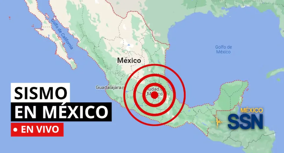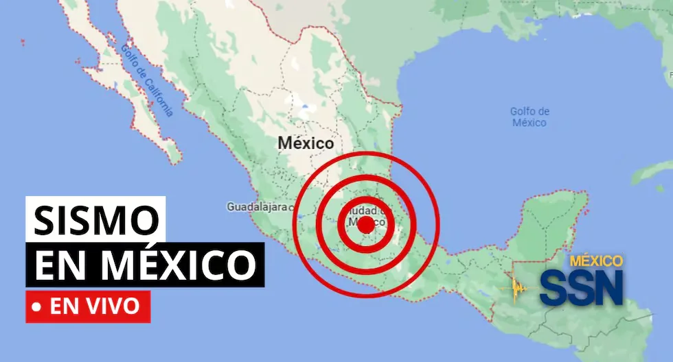








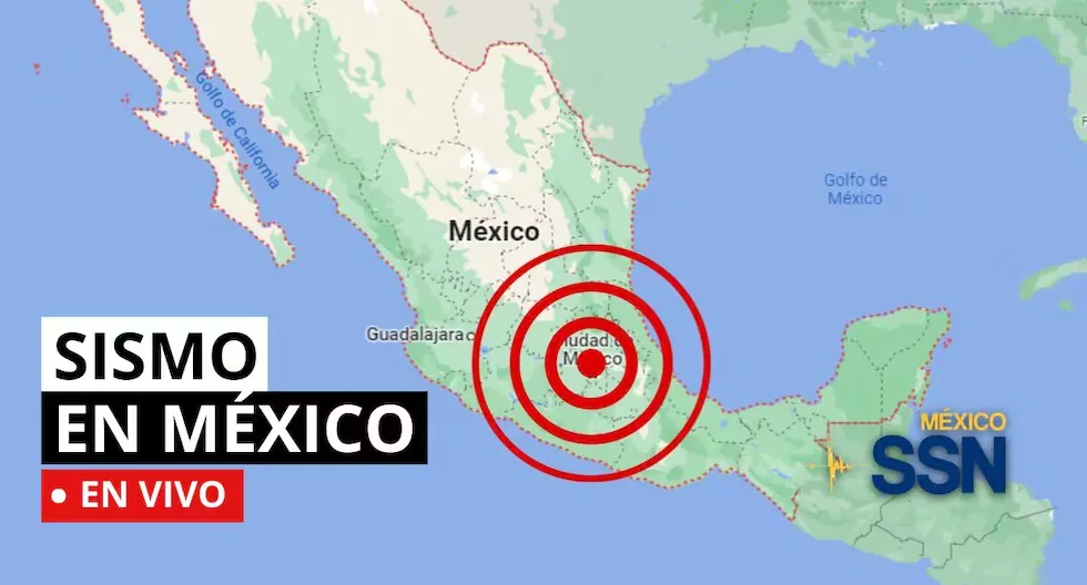
EARTHQUAKE IN MEXICO VIA THE NATIONAL SEISMOLOGICAL SERVICE
In the context of Plate Tectonics, Mexico is located in the so-called Ring of Fire, where a large part of the world’s telluric movements are recorded. The country is located on the North American Plate, limited in its southern and western portions by the Cocos, Rivera, and Pacific plates.
Read more TODAY’s Horoscope, Friday, July 24: find out the predictions according to your sign
Mexico is one of the countries in the world with the highest telluric activity, since, according to statistics, more than 90 earthquakes with a magnitude greater than 4 degrees on the Richter scale are recorded per year, which is equivalent to 60% of all telluric movements recorded in the world.
Based on statistical records, the states with the highest risk and where large magnitude earthquakes that can affect Mexico City occur are: Jalisco, Colima, Michoacán, Guerrero, Oaxaca, Puebla, State of Mexico, and Veracruz.
- WHAT IS AN EARTHQUAKE SWARM?
- An earthquake swarm is a group of earthquakes that occur in the same area over a short period of time. Unlike a single, strong earthquake, earthquake swarms usually consist of numerous smaller tremors. Often, there is no main earthquake that triggers the swarm; instead, seismic events occur more or less continuously and are related to tectonic processes.
- HOW TO ACT DURING AN EARTHQUAKE?
- • Go to the already established safety zones.
- • Stay away from glass or objects that could fall.
- • If possible, avoid panic and try to remain calm.
- • Do not run out into vehicle traffic areas.
- • If you are driving, stop your vehicle.
- • If you are in a building, do not use the elevator, always use the stairs.
- • Be attentive to minors, people with disabilities, and the elderly.
- HOW IS A TREMOR DIFFERENT FROM AN EARTHQUAKE?
- The terms “tremor” and “earthquake” are often used interchangeably, but generally, the difference lies in their magnitude, perceived intensity, and scope.
- • Tremor: Refers to seismic movements of lower intensity. Usually, they are used to describe low-magnitude ground tremors that do not cause significant damage to structures or people. They are perceptible, but their impact is mild.
- • Earthquake: Refers to a seismic event of greater magnitude. Earthquakes are significant seismic tremors that can cause serious damage to buildings, infrastructure, and, in the most severe cases, cause personal injuries and even loss of life. They have a considerable magnitude and are often accompanied by aftershocks.
- EARTHQUAKE OF MAGNITUDE 4.2 LOC. 113 KM SOUTHWEST OF CD HIDALGO, CHIS.
SISMO Magnitud 4.2 Loc 113 km al SUROESTE de CD HIDALGO, CHIS 23/07/26 23:21:10 Lat 14.19 Lon -93.07 Pf 11 km pic.twitter.com/UMvEZBScCw
— Sismologico Nacional (@SismologicoMX) July 24, 2026
- EARTHQUAKE OF MAGNITUDE 4.3 LOC. 135 KM SOUTHWEST OF CD HIDALGO, CHIS.
SISMO Magnitud 4.3 Loc 135 km al SUROESTE de CD HIDALGO, CHIS 23/07/26 22:28:29 Lat 13.94 Lon -93.15 Pf 15 km pic.twitter.com/BelZhaeSxb
— Sismologico Nacional (@SismologicoMX) July 24, 2026
- EARTHQUAKE OF MAGNITUDE 4.2 LOC. 97 KM SOUTHWEST OF CD HIDALGO, CHIS.
SISMO Magnitud 4.2 Loc 97 km al SUROESTE de CD HIDALGO, CHIS 23/07/26 22:19:36 Lat 14.00 Lon -92.72 Pf 10 km pic.twitter.com/rX9nqli4xm
— Sismologico Nacional (@SismologicoMX) July 24, 2026
- EARTHQUAKE OF MAGNITUDE 4.0 LOC. 52 KM SOUTH OF PINOTEPA NACIONAL, OAX.
SISMO Magnitud 4.0 Loc 52 km al SUR de PINOTEPA NACIONAL, OAX 23/07/26 19:19:41 Lat 15.88 Lon -98.12 Pf 12 km pic.twitter.com/gGCo82SIR4
— Sismologico Nacional (@SismologicoMX) July 24, 2026
- EARTHQUAKE OF MAGNITUDE 4.4 LOC. 145 KM SOUTHWEST OF CD HIDALGO, CHIS.
SISMO Magnitud 4.4 Loc 145 km al SUROESTE de CD HIDALGO, CHIS 23/07/26 17:21:05 Lat 13.95 Lon -93.27 Pf 10 km pic.twitter.com/Qc9H7CZn0Y
— Sismologico Nacional (@SismologicoMX) July 23, 2026
- EARTHQUAKE OF MAGNITUDE 4.4 LOC. 145 KM SOUTHWEST OF CD HIDALGO, CHIS.
SISMO Magnitud 4.4 Loc. 145 km al SUROESTE de CD HIDALGO, CHIS 23/07/26 17:21:05 Lat 13.95 Lon -93.27 Pf 10.0 km
— Sismologico Nacional (@SismologicoMX) July 23, 2026
- EARTHQUAKE OF MAGNITUDE 4.1 LOC. 119 KM SOUTHWEST OF CD HIDALGO, CHIS.
SISMO Magnitud 4.1 Loc 119 km al SUROESTE de CD HIDALGO, CHIS 23/07/26 17:11:11 Lat 14.06 Lon -93.06 Pf 10 km pic.twitter.com/NvNXuKdbA9
— Sismologico Nacional (@SismologicoMX) July 23, 2026
- EARTHQUAKE OF MAGNITUDE 4.4 LOC. 159 KM SOUTHWEST OF CD HIDALGO, CHIS.
SISMO Magnitud 4.4 Loc 159 km al SUROESTE de CD HIDALGO, CHIS 23/07/26 17:03:55 Lat 14.10 Lon -93.50 Pf 10 km pic.twitter.com/zJDN6I8pgj
— Sismologico Nacional (@SismologicoMX) July 23, 2026
- EARTHQUAKE OF MAGNITUDE 4.7 LOC. 159 KM SOUTHWEST OF CD HIDALGO, CHIS.
SISMO Magnitud 4.7 Loc 159 km al SUROESTE de CD HIDALGO, CHIS 23/07/26 16:39:03 Lat 14.00 Lon -93.45 Pf 10 km pic.twitter.com/xQYfhka3Ct
— Sismologico Nacional (@SismologicoMX) July 23, 2026
- WHY YOU SHOULD NEVER USE AN ELEVATOR DURING AN EARTHQUAKE?
- Specialists recommend never using the elevator during an earthquake or tremor, as it could detach from its structure and fall from a great height with people inside.
- EARTHQUAKE OF MAGNITUDE 4.7 LOC. 117 KM SOUTHWEST OF CD HIDALGO, CHIS (PRELIMINARY).
Preliminar: SISMO Magnitud 4.7 Loc 117 km al SUROESTE de CD HIDALGO, CHIS 23/07/26 16:39:06 Lat 14.13 Lon -93.08 Pf 10 km pic.twitter.com/n8iRmgTdaF
Read more Dollar price in Peru, Thursday, July 23: how much the exchange rate closed today
— Sismologico Nacional (@SismologicoMX) July 23, 2026
- EARTHQUAKE MAGNITUDE 4.3 LOC. 149 KM SOUTHWEST OF CD HIDALGO, CHIS.
SISMO Magnitud 4.3 Loc 149 km al SUROESTE de CD HIDALGO, CHIS 23/07/26 14:53:57 Lat 14.12 Lon -93.41 Pf 10 km pic.twitter.com/ztEBJu36v6
— Sismologico Nacional (@SismologicoMX) July 23, 2026
- EARTHQUAKE OF MAGNITUDE 4.3 LOC. 149 KM SOUTHWEST OF CD HIDALGO, CHIS.
SISMO Magnitud 4.3 Loc. 149 km al SUROESTE de CD HIDALGO, CHIS 23/07/26 14:53:57 Lat 14.12 Lon -93.41 Pf 10.0 km
— Sismologico Nacional (@SismologicoMX) July 23, 2026
- EARTHQUAKE OF MAGNITUDE 4.3 LOC 137 KM SOUTHWEST OF CD HIDALGO, CHIS.
SISMO Magnitud 4.3 Loc 137 km al SUROESTE de CD HIDALGO, CHIS 23/07/26 14:28:21 Lat 14.01 Lon -93.23 Pf 10 km pic.twitter.com/NqbCMAughz
— Sismologico Nacional (@SismologicoMX) July 23, 2026
- WHAT TO DO IN CASE OF A TSUNAMI?
- If you receive official tsunami alert or warning information or see the sea receding, evacuate to higher ground. Move to a flood-free area and head to the nearest meeting point. If you cannot reach higher ground, go up to an upper floor or the roof of a solid building.
- WHAT IS AN EARTHQUAKE SWARM?
- An earthquake swarm is a group of earthquakes that occur in the same area over a short period of time. Unlike a single, strong earthquake, earthquake swarms usually consist of numerous smaller tremors. Often, there is no main earthquake that triggers the swarm; instead, seismic events occur more or less continuously and are related to tectonic processes.
- CHECK WHAT A HOME EMERGENCY BACKPACK SHOULD CONTAIN.
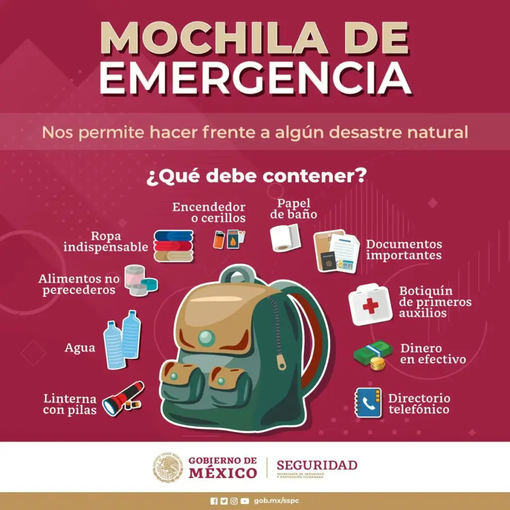
- WHAT SHOULD MY EMERGENCY BACKPACK CONTAIN?
- • Essential hygiene items
- • First aid kit (bandages, gauze, alcohol, pills, hydrogen peroxide, etc.)
- • Warm clothing
- • Non-perishable food (tuna cans, cereal bars, chocolates, nuts, etc.) and money
- • Communication items
- • Specific items for babies and infants, feminine hygiene products, for the elderly, and for other basic needs.
- WHAT WAS THE LARGEST MAGNITUDE EARTHQUAKE THAT SHOOK MEXICO CITY?
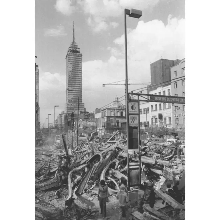
- On September 19, 1985, Mexico City experienced a devastating earthquake of 8.1 magnitude, with its epicenter on the Pacific coast. It is estimated that at least 10,000 people lost their lives, affecting and toppling thousands of housing, commercial, and public service structures.
- WHAT IS THE DIFFERENCE BETWEEN THE MAGNITUDE AND INTENSITY OF AN EARTHQUAKE?
- They are scales to measure the size or impact of a tremor. The magnitude scale is obtained numerically from records obtained by seismographs and is related to the size and energy released during a tremor. The intensity scale is assigned based on the damage or effects caused to humans and their constructions.
- WHY DO SO MANY EARTHQUAKES OCCUR IN MEXICO?
- In the context of Plate Tectonics, Mexico is located in the so-called Ring of Fire, where a large part of the world’s telluric movements are recorded. The country is located on the North American Plate, limited in its southern and western portions by the Cocos, Rivera, and Pacific plates.
Earthquake 147 km SOUTHWEST of CD HIDALGO, CHIS
Magnitude: 4.5
Date: 2026-07-23
Time: 6:04:43 (Central Time)
Latitude: 13.425º
Longitude: -92.612º
Depth: 6.7 km
Earthquake 24 km SOUTHWEST of PETATLAN, GRO
Magnitude: 3.6
Date: 2026-07-23
Time: 4:59:41 (Central Time)
Latitude: 17.422º
Longitude: -101.463º
Depth: 19.5 km
Earthquake 132 km SOUTHWEST of CD HIDALGO, CHIS
Magnitude: 4.4
Date: 2026-07-23
Time: 4:51:28 (Central Time)
Latitude: 14.019º
Longitude: -93.174º
Depth: 14.4 km
Earthquake 27 km SOUTHEAST of ACAPULCO, GRO
Magnitude: 3.5
Date: 2026-07-23
Time: 4:23:30 (Central Time)
Latitude: 16.716º
Longitude: -99.701º
Depth: 7.8 km
What to do after an earthquake?
Check for injuries, turn off gas and electricity leaks, avoid using the elevator, and stay away from damaged structures. If you are in a coastal area, check for tsunami alerts.
Why does the Earth shake?
Because tectonic plates move and accumulate energy. When this energy is suddenly released, an earthquake occurs.
How to prepare before an earthquake?
Conduct drills, have your emergency backpack ready, and plan an evacuation route with your family. Prevention saves lives.
What is the difference between an earthquake, tremor, sismo, and telluric movement?
They are synonyms, but in some countries “terremoto” (earthquake) is used for the most destructive seismic events.
What to do before an earthquake
• Have your emergency backpack ready.
• Identify safe zones at home, work, and on the street.
• Participate in drills.
What to do during an earthquake
• Stay calm.
• Protect yourself under a sturdy table or in the triangle of life.
• Stay away from windows and objects that could fall.
What to do after an earthquake
• Assess damage and check for injuries.
• Use text messages to communicate and avoid saturating phone lines.
• Stay away from damaged buildings and follow authorities’ instructions.
- WHAT WAS THE LARGEST MAGNITUDE EARTHQUAKE THAT SHOOK MEXICO CITY?
- On September 19, 1985, Mexico City experienced a devastating earthquake of 8.1 magnitude, with its epicenter on the Pacific coast.
- It is estimated that at least 10,000 people lost their lives, affecting and toppling thousands of housing, commercial, and public service structures.
- WHAT IS AN EARTHQUAKE?
An earthquake is a sudden rupture of rocks inside the Earth. This sudden release of energy propagates in the form of waves that cause the ground to move.
- HOW LONG DOES AN EARTHQUAKE LAST AND WHY DOES THE SSN NOT REPORT THIS DATA?
When we talk about the duration of an earthquake, we can refer to several different concepts: One is the duration of the movement perceived by humans, another is the duration of the instrumental record (which can even be several minutes), and another is the time the fault movement that originated the earthquake lasted (which can be a few seconds).
- WHAT IS THE DIFFERENCE BETWEEN THE MAGNITUDE AND INTENSITY OF AN EARTHQUAKE?
They are scales to measure the size or impact of a tremor. The magnitude scale is obtained numerically from records obtained by seismographs and is related to the size and energy released during a tremor. The intensity scale is assigned based on the damage or effects caused to humans and their constructions.
Mexico is one of the countries in the world with the highest telluric activity, since, according to statistics, more than 90 earthquakes with a magnitude greater than 4 degrees on the Richter scale are recorded per year, which is equivalent to 60% of all telluric movements recorded in the world.
What was the magnitude and location of the last tremor in Mexico? See live reports from the National Seismological Service (SSN) on earthquakes in the country here.
Read more ESPN LIVE — Bolívar-Gremio ONLINE for Copa Sudamericana playoffs