![Alberto Beingolea: “If they insist on not giving [the powers], they are complicating life for Peru”](https://insightermedia.com/wp-content/uploads/2026/09/bb3fa9e11304ea13fe2cd333955007bc-150x150.webp "Alberto Beingolea: “If they insist on not giving [the powers], they are complicating life for Peru”")



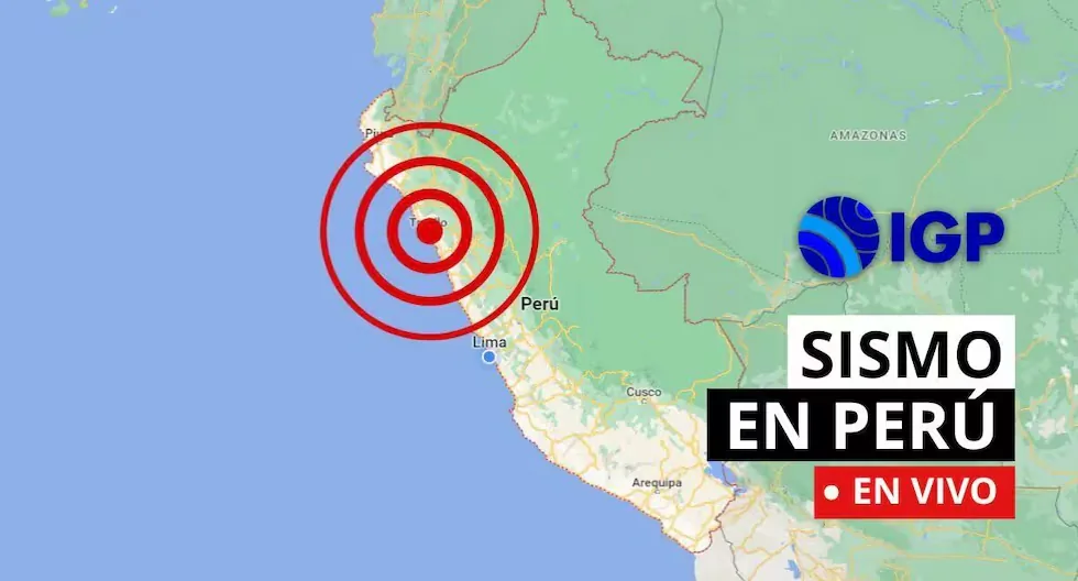
Follow live all seismic movements in the country, according to reports published by the Geophysical Institute of Peru. Also consult related news, as well as recommendations in these types of situations.
Earthquake in Peru via the IGP
- EARTHQUAKE 42 KM S OF CHALA, CARAVELÍ – AREQUIPA.
REPORTE SÍSMICO:
— Centro Sismológico Nacional (@Sismos_Peru_IGP) August 26, 2026
IGP/CENSIS/RS 2026-0592
Fecha y Hora Local: 26/08/2026,14:29:19
Magnitud: 4.2
Profundidad: 22 km
Latitud: -16.24
Longitud: -74.18
Intensidad: III Chala
Referencia: 42 km al S de Chala, Caravelí – Arequipahttps://t.co/LAz5qy8aL0
- EMERGENCY PHONE NUMBERS – PERU
- • Emergency line: 105
- (It is the single national emergency line, which allows Peruvians to access all emergency and security services with just one number).
- • National Police: 105
- • Firefighters: 116
- • Highway Police: 110
- • Civil Defense: 115
- • Infosalud: 113
- • Red Cross: 01 266 0481
- • SAMU Ambulance Service: 106
- WHY IS PERU A HIGHLY SEISMIC COUNTRY?
- Peru is located on the western edge of South America, a region with the highest seismic activity in the world, and therefore, it is necessary to understand the probable behavior of this hazard in a given area in order to plan and mitigate the effects that could occur in the future. The way to understand this behavior is through seismic hazard assessment.
- HOW ARE EARTHQUAKE DATA OBTAINED IN PERU?
- CENSIS obtains its data from the National Seismic Network (DS-0017-2018MINAM), formed and integrated by a series of velocity, acceleration, and displacement sensors distributed throughout the country.
What to do after an earthquake?
Check for injuries, turn off gas and electricity leaks, avoid using the elevator, and stay away from damaged structures. If you are in a coastal area, check for tsunami alerts.
Why does the Earth shake?
Because tectonic plates move and accumulate energy. When this energy is suddenly released, an earthquake occurs.
How to prepare before an earthquake?
Conduct drills, have your emergency backpack ready, and plan an evacuation route with your family. Prevention saves lives.
What is the difference between an earthquake, tremor, seismic event, and telluric movement?
They are synonyms, but in some countries “earthquake” is used for the most destructive seismic events.
How is a tremor different from an earthquake?
Both are movements of the Earth, but we usually call “earthquake” those of greater magnitude and destructive impact, while “tremor” is used for milder seismic events.
How to know if an earthquake is strong?
There are two ways:
– Magnitude, measured on the Richter scale, indicates the energy released.
– Intensity, measured on the Mercalli scale, measures the impact on people and structures.
Earthquake 20 km W of Huánuco, Huánuco – Huánuco
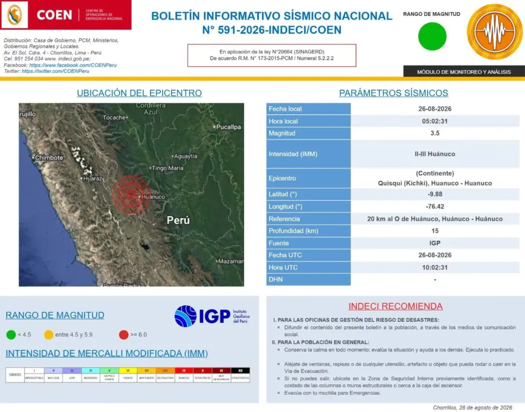
Earthquake 20 km W of Huánuco, Huánuco – Huánuco
Local Date and Time: 26/08/2026,05:02:31
Magnitude: 3.5
Depth: 15 km
Latitude: -9.88
Longitude: -76.42
Intensity: II-III Huánuco
Earthquake 17 km S of Chupaca, Chupaca – Junín
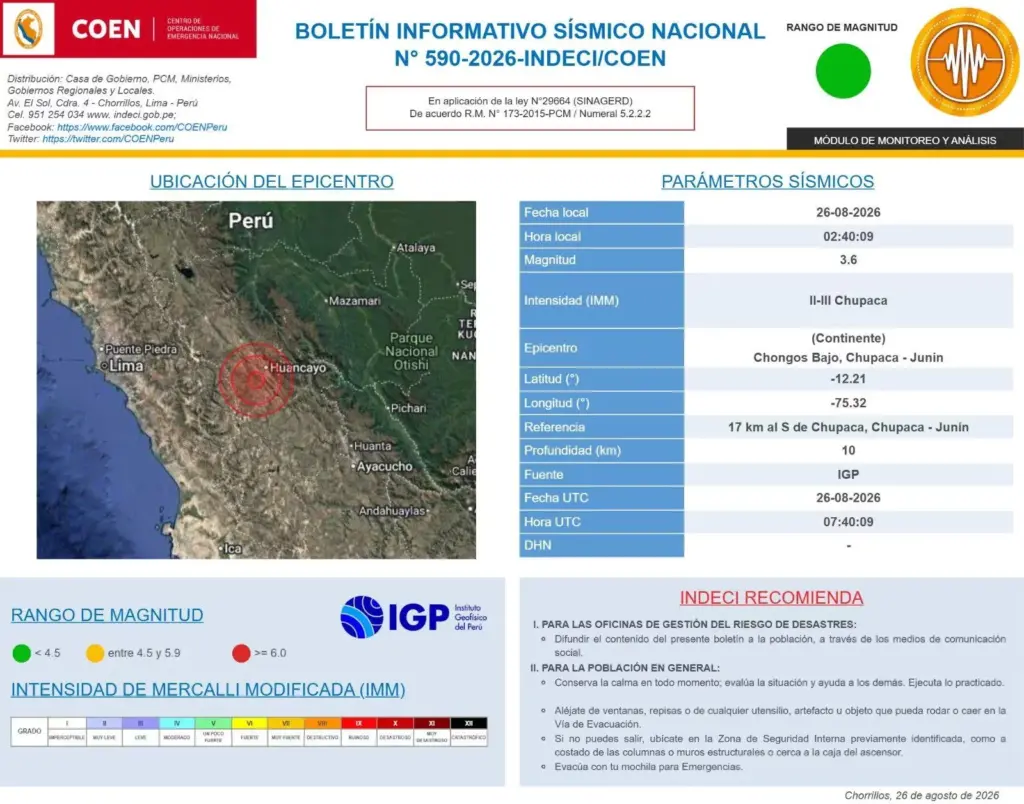
Earthquake 17 km S of Chupaca, Chupaca – Junín
Local Date and Time: 26/08/2026,02:40:09
Magnitude: 3.6
Depth: 10 km
Latitude: -12.21
Longitude: -75.32
Intensity: II-III Chupaca
Earthquake 61 km E of Zarumilla, Zarumilla – Tumbes
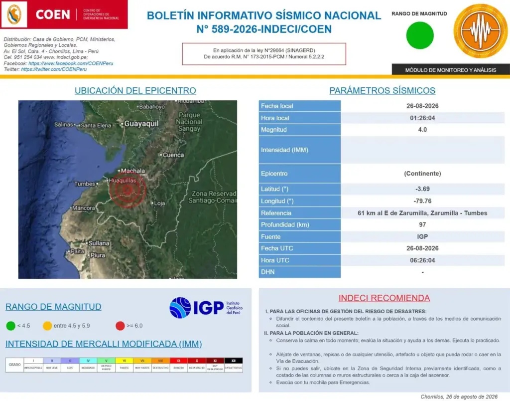
Earthquake 61 km E of Zarumilla, Zarumilla – Tumbes
Local Date and Time: 26/08/2026,01:26:04
Magnitude: 4.0
Depth: 97 km
Latitude: -3.69
Longitude: -79.76
Why are multiple magnitudes reported for the same earthquake?
Because the initial information comes from nearby stations and is adjusted as more data arrives from different sensors. Science continues calculating after the first alert.
How do we know an earthquake is coming?
Earthquakes cannot be predicted, but seismographs and accelerographs detect ground movements in real time to alert us as quickly as possible.
What to do if I’m on the street when an earthquake starts?
Look for an open space away from poles, trees, or buildings. Be careful with electrical wires. If you are driving, stop cautiously in a safe place.
What should my emergency backpack contain?
It should contain the essentials for survival in the first hours after an earthquake:
– Hygiene items
– First aid kit with bandages, alcohol, gauze, pills, among others
– Warm clothing
– Non-perishable foods such as tuna, energy bars, chocolates, and dried fruits, plus cash
– Radio or flashlight with batteries
– Specific items according to needs, such as products for babies, the elderly, or pets
- Earthquake 16 km S of Chupaca, Chupaca – Junín
Local Date and Time: 25/08/2026,21:51:19
Magnitude: 3.8
Depth: 11 km
Latitude: -12.20
Longitude: -75.33
Intensity: III Chupaca
- Earthquake 26 km SW of Zorritos, Contralmirante Villar – Tumbes
Local Date and Time: 25/08/2026,20:34:19
Magnitude: 4.2
Depth: 59 km
Latitude: -3.81
Longitude: -80.85
Intensity: II Zorritos
What to do if I’m on the street when an earthquake starts?
Look for an open space away from poles, trees, or buildings. Be careful with electrical wires. If you are driving, stop cautiously in a safe place.
Read more Can data be rectified on a minor’s DNI via web? Reniec responds
How to know if an earthquake is strong?
There are two ways:
– Magnitude, measured on the Richter scale, indicates the energy released.
– Intensity, measured on the Mercalli scale, measures the impact on people and structures.
How is a tremor different from an earthquake?
Both are movements of the Earth, but we usually call “earthquake” those of greater magnitude and destructive impact, while “tremor” is used for milder seismic events.
Why are multiple magnitudes reported for the same earthquake?
Because the initial information comes from nearby stations and is adjusted as more data arrives from different sensors. Science continues calculating after the first alert.
How do we know an earthquake is coming?
Earthquakes cannot be predicted, but seismographs and accelerographs detect ground movements in real time to alert us as quickly as possible.
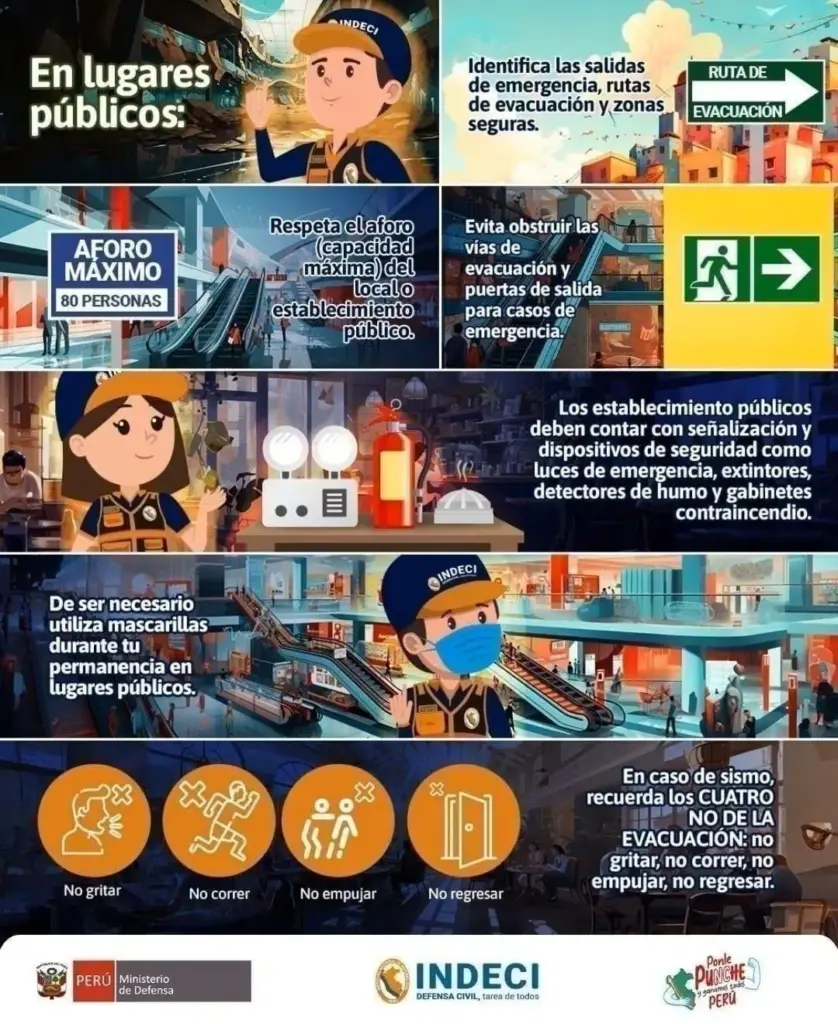
- Identify evacuation routes, respect capacity limits, avoid blocking exits, and recognize safety devices.
- What is the difference between a seismic event, tremor, and earthquake?
Hernando Tavera, executive president of the Geophysical Institute of Peru (IGP), stated that, fundamentally, they mean the same thing and that the use of these terms ‘is more a matter of tradition in each population or country’.
Regarding Peru, he pointed out that the word earthquake is used when the movement causes human losses and material damage such as collapsed houses.
- The Geophysical Institute of Peru (IGP) is the only Peruvian state agency responsible for issuing official seismic information.
- WHAT ARE SEISMIC MOVEMENTS?
- According to INDECI, earthquakes are “phenomena that represent the release of the Earth’s internal energy, through the rupture of crustal layers, and manifest as undulating movements that can reach varied magnitudes.”
- If these movements are slight, they are called TREMORS.
- If they are of greater magnitude and reach higher intensities, they are called EARTHQUAKES.
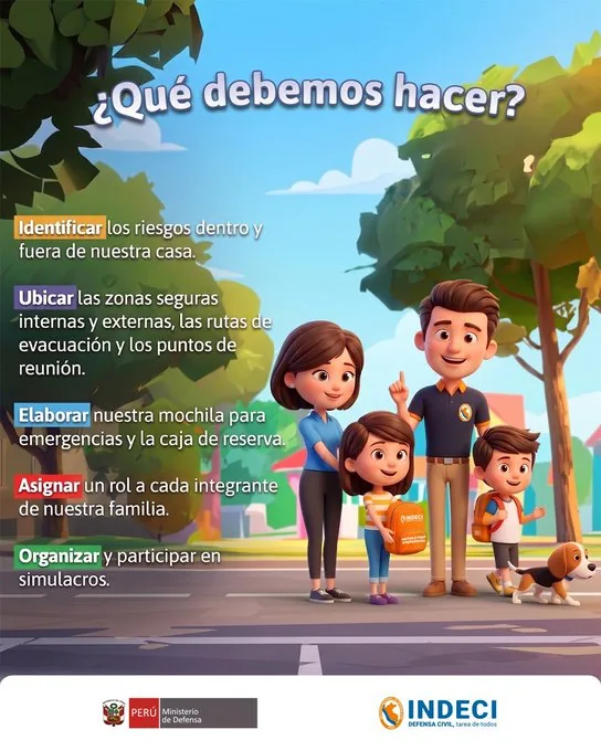
- HAVE YOUR SURVIVAL COMBO READY FOR ANY EMERGENCY
??Elabora tu combo de la supervivencia ????+????y prepárate ante emergencias y desastres. pic.twitter.com/R3GZzDUvHq
— INDECI (@indeciperu) August 24, 2026
Review or update your Family Emergency Plan and better prepare for emergencies and disasters.
- WHAT IS THE LARGEST MAGNITUDE EARTHQUAKE RECORDED BY INSTRUMENTS IN PERU?
On Thursday, October 3, 1974, an 8.0-magnitude earthquake was recorded in Lima at 9:21 a.m., striking the capital of Peru, as well as a large part of the Peruvian coast, to the south. The movement lasted about 90 seconds and left a toll of 252 dead and 3,600 injured.
Peru is located in a seismic zone, and the occurrence of earthquakes is inevitable. An IGP study indicates that there is accumulated seismic energy in the south of the country, which should encourage participation in drills.
The entity responsible for keeping a record of every tremor in the country is the Geophysical Institute of Peru (IGP). It also provides official information whenever an earthquake occurs through its social media accounts.
- HOW ARE EARTHQUAKE DATA OBTAINED IN PERU?
CENSIS obtains its data from the National Seismic Network (DS-0017-2018MINAM), formed and integrated by a series of velocity, acceleration, and displacement sensors distributed throughout the country.
- WHY IS PERU A HIGHLY SEISMIC ZONE?
Peru is a highly seismic country because it is located within the Pacific Ring of Fire.
- Consult here the latest records from the Geophysical Institute of Peru on seismic movements in the country.
• La Kábala: results for Thursday, August 20, 2026