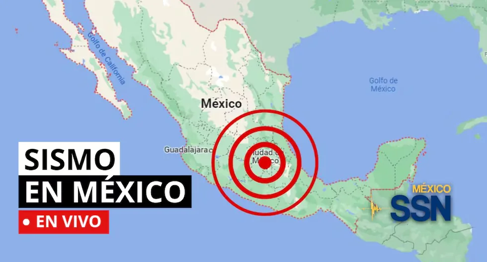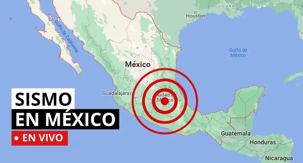






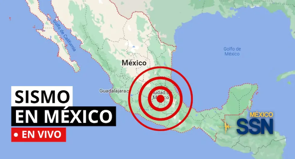
EARTHQUAKE IN MEXICO VIA THE NATIONAL SEISMOLOGICAL SERVICE
In the context of Plate Tectonics, Mexico is located in the so-called Ring of Fire, where a large part of the seismic movements worldwide are recorded. The country is located on the North American Plate, bordered on its southern and western portion by the Cocos, Rivera, and Pacific plates.
Read more La Tinka of Wednesday, September 9: Link to play online and official draw time on América TV
Mexico is one of the countries in the world with the highest seismic activity, as according to statistics, more than 90 earthquakes per year with a magnitude greater than 4 on the Richter scale are recorded, which is equivalent to 60% of all seismic movements recorded worldwide.
Based on statistical records, the states with the highest risk and where large magnitude earthquakes that can affect Mexico City occur are: Jalisco, Colima, Michoacán, Guerrero, Oaxaca, Puebla, State of Mexico, and Veracruz.
The National Seismological Service reported that during the activities of the 2nd National Drill 2026 on September 19 at 12:00 pm, the SSN social networks will operate normally.
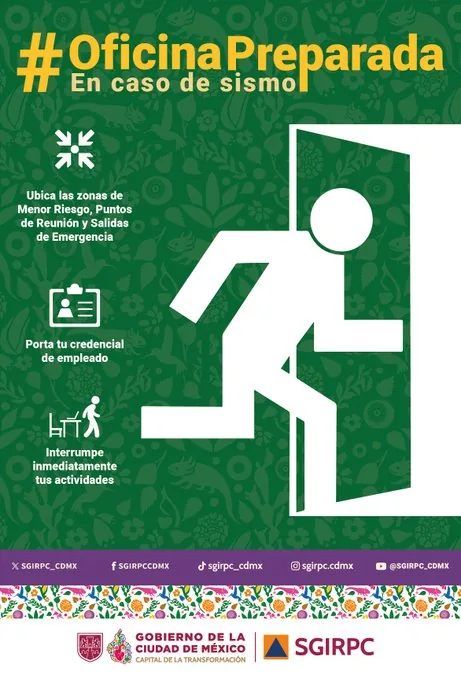
- In case of an earthquake at your workplace, keep the following recommendations in mind.
- How often should the survival kit be checked?
It is recommended to check the backpack every 6 months to verify the expiration date of food, water, and medicines, as well as the condition of the batteries.
- How often should the survival kit be checked?
It is recommended to check the backpack every 6 months to verify the expiration date of food, water, and medicines, as well as the condition of the batteries.
- Earthquake 61 km south of Salina Cruz, Oaxaca
Magnitude: 4.1
Date: 09/09/26
Time: 02:18:29
Latitude: 15.65
Longitude: -95.06
Depth: 17 km
- Earthquake 79 km southwest of Ciudad Hidalgo, Chiapas
Magnitude: 4.0
Date: 08/09/26
Time: 23:05:41
Latitude: 14.19
Longitude: -92.69
Depth: 15 km
- As of 8:00 pm on September 8, 2026, 2,414 aftershocks of the M 7.4 earthquake that occurred in Ciudad Hidalgo, Chiapas on July 17, 2026, have been recorded, the largest with a magnitude of M 6.5.
- EARTHQUAKE 5 km SOUTHWEST of SAN MARCOS, GRO
- Magnitude 4.0
- Date: 2026-09-08
- Time: 19:28:12 (Central Time)
- Latitude: 16.776º
- Longitude: -99.433º
- Depth: 9.3 km
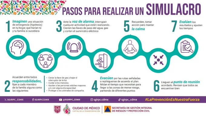
- STEPS TO CONDUCT A DRILL:
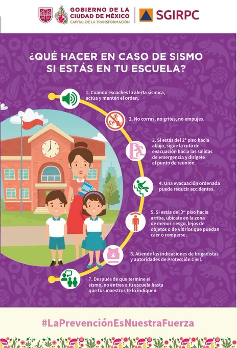
Follow the following recommendations if you are at a school.
- CAN EARTHQUAKES BE PREDICTED?
To date, there is no technique that allows predicting earthquakes. Not even countries like the United States and Japan, whose technology is very advanced, have been able to develop a predictive technique for tremors. Since we live in a country with high seismic activity, the only certainty we have is that it constantly shakes and that we must be prepared. In any seismic event, the only thing that can help us is prevention.
Keep the following recommendations in mind if a seismic movement occurs at your workplace.

Monthly seismicity summary August 2026 according to the SSN.
Monthly seismicity summary August 2026
— National Seismological Service (@SSNMexico) September 8, 2026
More information: https://t.co/tj9140isK5 pic.twitter.com/xMqsfztWtu
- EARTHQUAKE 7 km SOUTHEAST of SAN JOSE DEL CABO, BCS
- Magnitude 2.7
- Date: 2026-09-08
- Time: 13:21:42 (Central Time)
- Latitude: 23.026º
- Longitude: -109.651º
- Depth: 8.0 km
- Why are multiple magnitudes reported for the same earthquake?
Because the first information comes from nearby stations and is adjusted as more data arrives from different sensors. Science continues calculating after the first alert.
- How do we know it will shake?
Earthquakes cannot be predicted, but seismographs and accelerographs detect ground movements in real time to alert us as quickly as possible.
Read more Earthquake in Venezuela today, Wednesday, September 9: check the latest tremors
- Lead Time or Alert Time
SASMEX considers lead time as the interval between the moment the population hears the official seismic alert sound and the moment the earthquake reaches the city in the phases of greatest seismic intensity. It provides approximately from 20 to 120 seconds of lead time before the arrival of an earthquake depending on the distance to the epicenter and the first detections from the stations.
- Cities that Broadcast the Seismic Alert
The SASMEX® seismic alert warnings are received by the population of: Mexico City, Puebla, Acapulco, Chilpancingo, Morelia, Oaxaca, Toluca, Cuernavaca (which rebroadcasts the Mexico City alert) and Colima. Warnings that benefit more than 25 million people in seismic risk areas.
- How does it work?
With the Mexican Seismic Alert System, seismic sensors calculate parameters used to forecast a strong earthquake near their coverage area; these parameters are sent by radio to computer systems located in the city to be alerted.
Information from seismic sensors near the earthquake location allows the automatic issuance of alert warnings via radio waves that anticipate the effects of a strong earthquake because radio waves travel faster than seismic waves.
- How often should the survival kit be checked?
It is recommended to check the backpack every 6 months to verify the expiration date of food, water, and medicines, as well as the condition of the batteries.
- How often should the survival kit be checked?
It is recommended to check the backpack every 6 months to verify the expiration date of food, water, and medicines, as well as the condition of the batteries.
The Seismic Alert is automatically activated when stations installed on the coast of Guerrero detect the start of a large magnitude earthquake and send the signal.
Initially, alert warnings were broadcast through the Personalized Seismic Alert System (SASPER); installed in some schools, government buildings, and emergency institutions. Currently, we can timely warn the population at seismic risk with alert warnings broadcast through special regional radio stations, whose signal allows the automatic operation of economical receivers designed to warn of natural hazards called the Mexican Risk Warning System.
- Earthquake 56 km northeast of Matías Romero, Oaxaca
Magnitude: 4.1
Date: 08/09/26
Time: 02:46:52
Latitude: 17.04
Longitude: -94.55
Depth: 139 km
- Earthquake 42 km southeast of Petatlán, Guerrero
Magnitude: 4.0
Date: 08/09/26
Time: 00:58:54
Latitude: 17.24
Longitude: -101.04
Depth: 25 km
- WHAT IS SEISMIC SILENCE?
- Seismic silence is a prolonged period without significant or intense seismic activity in a region, which may indicate the accumulation of tectonic stresses and an increased risk of a future earthquake.
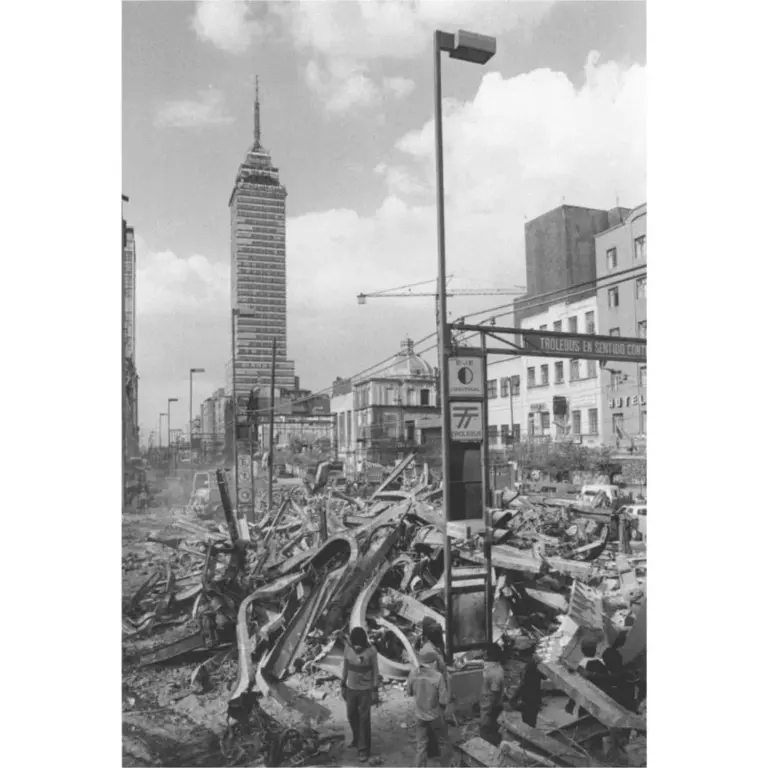
- WHAT IS AN EARTHQUAKE?
- An earthquake is a sudden rupture of rocks inside the Earth. This sudden release of energy propagates as waves that cause ground movement.
- HOW LONG DOES AN EARTHQUAKE LAST AND WHY DOES THE SSN NOT REPORT THIS DATA?
- When we talk about the duration of an earthquake, we can refer to several different concepts: One is the duration of the movement perceived by humans, another is the duration of the instrumental record (which can be several minutes), and another is the time the fault movement that caused the earthquake lasted (which can be a few seconds).
- WHAT IS THE DIFFERENCE BETWEEN THE MAGNITUDE AND INTENSITY OF AN EARTHQUAKE?
- They are scales to measure the size or impact of a tremor. The magnitude scale is obtained numerically from records obtained by seismographs and is related to the size and energy released during a tremor. The intensity scale is assigned based on the damage or effects caused to people and their constructions.
- WHY DO SO MANY EARTHQUAKES OCCUR IN MEXICO?
- In the context of Plate Tectonics, Mexico is located in the so-called Ring of Fire, where a large part of the seismic movements worldwide are recorded. The country is located on the North American Plate, bordered on its southern and western portion by the Cocos, Rivera, and Pacific plates.
- Mexico is one of the countries in the world with the highest seismic activity, as according to statistics, more than 90 earthquakes per year with a magnitude greater than 4 on the Richter scale are recorded, which is equivalent to 60% of all seismic movements recorded worldwide.
What was the magnitude and where was the last earthquake in Mexico? Watch live here the reports from the National Seismological Service SSN about earthquakes in the country.