![Alberto Beingolea: “If they insist on not giving [the powers], they are complicating life for Peru”](https://insightermedia.com/wp-content/uploads/2026/09/bb3fa9e11304ea13fe2cd333955007bc-150x150.webp "Alberto Beingolea: “If they insist on not giving [the powers], they are complicating life for Peru”")



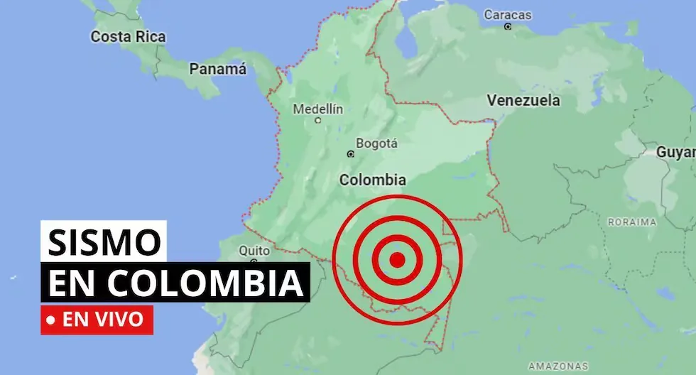
Earthquake in Colombia via the Geological Service
The SGC has a total of 339 seismic stations, located throughout the Colombian territory and in specific areas such as active volcanoes. 206 seismic stations are located covering the entire territory corresponding to the National Seismic Network and 133 seismic stations installed on the active Colombian volcanoes that are permanently monitored in three volcanological and seismological observatories.
Read more When does the pilot plan for the Bidirectional Lane on Av Arequipa of the Blue Corridor start?
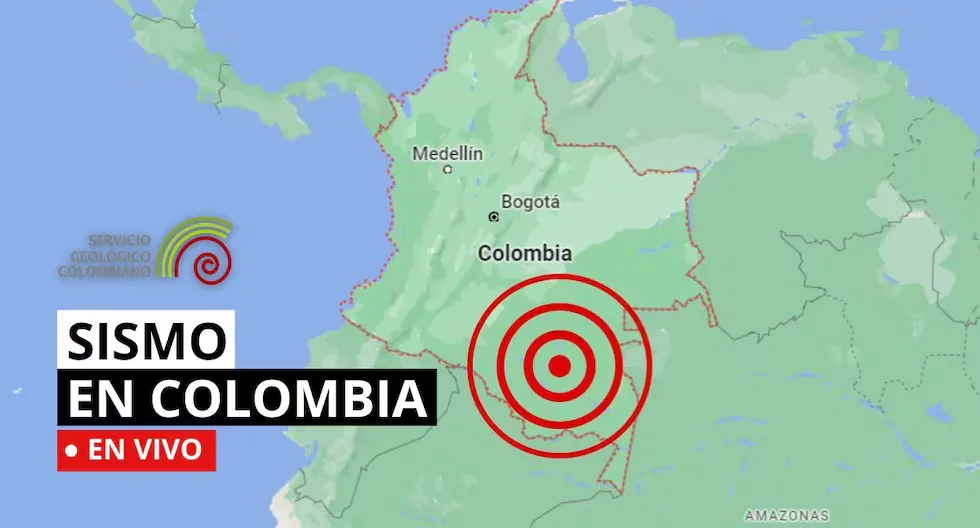
Find out here about the earthquakes that occurred in Colombian territory, reported by the Geological Service. Here we tell you which were the latest.
- Earthquake in Cáceres – Antioquia, Colombia
Magnitude: 2.6
Depth: Shallow (Less than 30 km)
Local time: 2026-08-02 12:49:59
UTC time: 2026-08-02 17:49:59
Latitude: 7.68°
Longitude: -75.34°
- How much should the survival backpack weigh?
The ideal weight should not exceed 25% of the body weight of the person who will carry it, ensuring a quick and agile evacuation.
- Can an earthquake be predicted?
Currently, it is impossible to determine, since the Earth itself presents a wide dynamic regarding its movements, considering that it is not only about predicting when it will shake, but being able to determine the intensity, magnitude, depth, and other important factors.
- Earthquake in Riosucio – Chocó, Colombia
Magnitude: 3.7
Depth: Shallow (Less than 30 km)
Local time: 2026-08-02 12:12:33
UTC time: 2026-08-02 17:12:33
Latitude: 7.59°
Longitude: -77.24°
- Earthquake in Cáchira – Norte de Santander, Colombia
Magnitude: 3
Depth: 113 km
Local time: 2026-08-02 11:23:03
UTC time: 2026-08-02 16:23:03
Latitude: 7.67°
Longitude: -73.18°
- Earthquake in Dabeiba – Antioquia, Colombia
Magnitude: 3.2
Depth: Shallow (Less than 30 km)
Local time: 2026-08-02 11:11:52
UTC time: 2026-08-02 16:11:52
Latitude: 6.95°
Longitude: -76.25°
- Earthquake in Puerto Boyacá – Boyacá, Colombia
Magnitude: 2.5
Depth: Shallow (Less than 70 km)
Local time: 2026-08-02 11:10:00
UTC time: 2026-08-02 16:10:00
Latitude: 6.02°
Longitude: -74.48°
- Earthquake in Hobo – Huila, Colombia
Magnitude: 2.1
Depth: Shallow (Less than 70 km)
Local time: 2026-08-02 10:12:07
UTC time: 2026-08-02 15:12:07
Latitude: 2.51°
Longitude: -75.39°
- Earthquake in Zapatoca – Santander
- Local Date and Time: 2026-08-02 09:42
- Magnitude: 3.4
- Depth: 136 km
- Latitude: 6.72
- Longitude: -73.24
- Earthquake in Zapatoca – Santander
- Local Date and Time: 2026-08-02 09:42
- Magnitude: 3.4
- Depth: 136 km
- Latitude: 6.72
- Longitude: -73.24
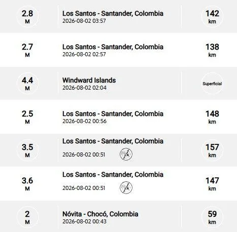
Recent earthquakes reported by the SGC.
- How often should the survival kit be checked?
It is recommended to check the backpack every 6 months to verify the expiration date of food, water, and medicines, as well as the condition of the batteries.
- Where should the emergency backpack be stored?
It should be located in a visible, dry, and easily accessible place, preferably near the main exit door of the home.
- How much should the survival backpack weigh?
The ideal weight should not exceed 25% of the body weight of the person who will carry it, ensuring a quick and agile evacuation.
- Can an earthquake be predicted?
Currently, it is impossible to determine, since the Earth itself presents a wide dynamic regarding its movements, considering that it is not only about predicting when it will shake, but being able to determine the intensity, magnitude, depth, and other important factors.
- Earthquake in Los Santos – Santander, Colombia
Magnitude: 2.3
Depth: 143 km
Local time: 2026-08-01 16:09:59
UTC time: 2026-08-01 21:09:59
Latitude: 6.76°
Longitude: -73.10°
- Earthquake in Murindó – Antioquia, Colombia
Magnitude: 2
Depth: Shallow (Less than 30 km)
Local time: 2026-08-01 11:43:41
UTC time: 2026-08-01 16:43:41
Latitude: 6.74°
Longitude: -76.6
- Earthquake in Los Santos – Santander, Colombia
- Magnitude: 2
- Depth: 141 km
- Local time: 2026-08-01 14:09:16
- UTC time: 2026-08-01 19:09:16
- Latitude: 6.80°
- Longitude:-73.12°
- Earthquake in Los Santos – Santander, Colombia
Magnitude: 2.3
Depth: 140 km
Local time: 2026-08-01 11:09:59
UTC time: 2026-08-01 16:09:59
Latitude: 6.79°
Longitude: -73.14°
- Earthquake in Chimichagua – Cesar, Colombia
- Magnitude: 2.8
- Depth: Shallow (Less than 30 km)
- Local time: 2026-08-01 10:42:18
- UTC time: 2026-08-01 15:42:18
- Latitude: 9.09°
- Longitude:-73.66°
- HOW TO ACT DURING AN EARTHQUAKE?
• Go to the already established safety zones.
• Stay away from glass or objects that could fall.
• If possible, avoid panic and try to stay calm.
• Do not run in vehicle passage areas.
• If you are driving, stop your vehicle.
• If you are in a building, do not use the elevator, always use the stairs.
• Be attentive to minors, disabled people, and the elderly.
- These are the municipalities with the highest record of tremors in Colombia
- Los Santos – Santander
- Zapatoca – Santander
- Villanueva – Santander
- Jordán – Santander
- Dabeiba – Antioquia
- Uribe – Meta
- Mesetas – Meta
- Caribbean Sea
- El Carmen – Santander
- Has seismic activity increased in recent years worldwide? In Colombia?
Generally, seismic activity worldwide and in Colombia has not had a considerable increase; what happens is that humans have populated new areas of the planet, which were previously uninhabited, and because of this, earthquakes are now more talked about, explains the National Seismological Network of Colombia-RSNC.
Read more What did the Minister of Labor say about vacations and payment of CTS and bonuses in Peru?
- Earthquake in Becerrill – Cesar, Colombia
- Magnitude: 2.4
- Depth: Shallow (Less than 70 km)
- Local time: 2026-08-01 12:26:18
- UTC time: 2026-08-01 17:26:18
- Latitude: 9.77°
- Longitude:-73.32°
- What should I include in an emergency backpack for earthquakes?
Drinking water, non-perishable food, flashlight, batteries, portable radio, first aid kit, personal medications, copies of important documents, whistle, light clothing, face mask, and portable cell phone charger.
- Earthquake in Curumaní – Cesar, Colombia
- Magnitude: 2.7
- Depth: Shallow (Less than 30 km)
- Local time: 2026-08-01 10:42:18
- UTC time: 2026-08-01 15:42:18
- Latitude: 9.15°
- Longitude:-73.64°
- EMERGENCY PHONE NUMBERS – COLOMBIA
- • Emergency line: 123
- (It is the single national emergency line, which allows Colombians to access all emergency and security services offered by the State with just one number)
- • National Police: 112
- • Traffic Police: 127
- • Civil Defense: 144
- • Firefighters: 119
- • Red Cross: 132
- • Ambulance Service: 125
- • Gaula – Anti-kidnapping: 165
- • Disaster Attention: 111
- CAN EARTHQUAKES BE PREDICTED?
- So far, there is no reliable technique anywhere in the world for earthquake forecasting, and we are still far from achieving it.
- However, although earthquakes cannot be predicted in time, they can be predicted in space, meaning it can be said that an earthquake will occur in certain areas, but when it will happen is unknown.
WHAT IS AN EARTHQUAKE?
An earthquake is a sudden rupture of rocks inside the Earth. This sudden release of energy propagates in the form of waves that cause ground movement.
WHAT IS THE DIFFERENCE BETWEEN MAGNITUDE AND INTENSITY OF AN EARTHQUAKE?
They are scales to measure the size or impact of a tremor. The magnitude scale is obtained numerically from records obtained by seismographs and is related to the size and energy released during a tremor. The intensity scale is assigned based on the damage or effects caused to people and their constructions.
WHAT IS THE DIFFERENCE BETWEEN EARTHQUAKE, TREMOR, SEISM, AND TELURIC MOVEMENT?
Actually, the four terms are synonyms, but in Latin America, special emphasis has been given to the term earthquake to refer to destructive earthquakes or those that have caused casualties.
HOW MANY SEISMOGRAPHS ARE THERE?
NATIONAL SEISMOLOGICAL NETWORK OF COLOMBIA-RSNC
The SGC has a total of 339 seismic stations, located throughout the Colombian territory and in specific areas such as active volcanoes. 206 seismic stations are located covering the entire territory corresponding to the National Seismic Network.
There are 133 seismic stations installed on the active Colombian volcanoes that are permanently monitored in three volcanological and seismological observatories.
WHAT IS THE COLOMBIAN GEOLOGICAL SERVICE?
The SGC is a century-old science and technology entity attached to the Ministry of Mines and Energy, whose objective is to contribute to the country’s economic and social development through research in basic and applied geosciences of the subsurface, the potential of its resources, the evaluation and monitoring of geological hazards, the comprehensive management of geoscientific knowledge, research, and nuclear and radioactive control, addressing the priorities of the National Government’s policies.
What was the magnitude and where was the last tremor? See here the reports from the Colombian Geological Service (SGC) about the latest earthquakes in the country.
Read more Netflix adds the first 5 (and best) seasons of “Chicago PD” to its catalog