![Alberto Beingolea: “If they insist on not giving [the powers], they are complicating life for Peru”](https://insightermedia.com/wp-content/uploads/2026/09/bb3fa9e11304ea13fe2cd333955007bc-150x150.webp "Alberto Beingolea: “If they insist on not giving [the powers], they are complicating life for Peru”")



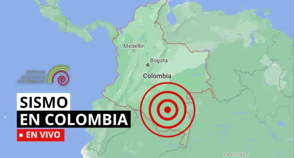
Earthquake in Colombia via the Geological Service
The SGC has a total of 339 seismic stations, located throughout the Colombian territory and in specific areas such as active volcanoes. 206 seismic stations are located covering the entire territory corresponding to the National Seismic Network and 133 seismic stations installed on the active Colombian volcanoes that are permanently monitored in three volcanological and seismological observatories.
Find out here about the earthquakes that occurred in Colombian territory, reported by the Geological Service. Here we tell you about the latest ones.
- Earthquake in Istmina – Chocó, Colombia
- Magnitude: 3.4
- Depth: 40 km
- Local time: 2026-08-24 06:27:38
- UTC time: 2026-08-24 11:27:38
- Latitude: 4.43°
- Longitude:-76.76°
- UPDATED EARTHQUAKE REPORTS
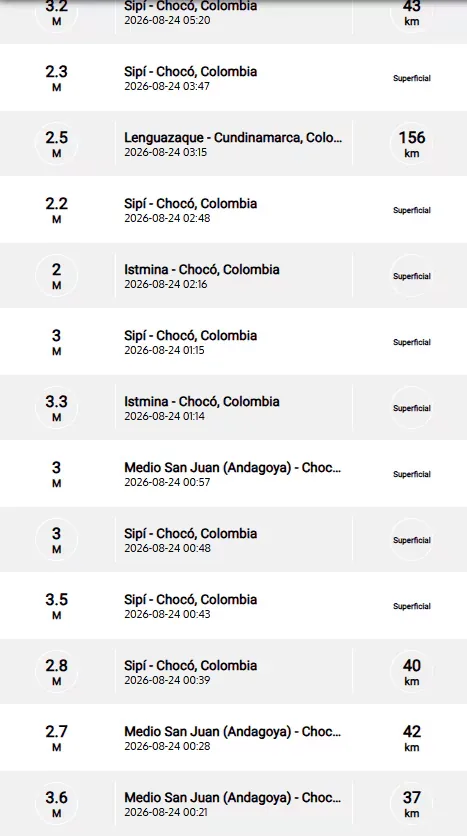
Earthquake in Istmina – Chocó, Colombia
Magnitude: 3.7
Depth: Shallow (Less than 30 km)
Local time: 2026-08-23 21:40:59
UTC time: 2026-08-24 02:40:59
Latitude: 4.49°
Longitude: -76.78°
Earthquake in Istmina – Chocó, Colombia
Magnitude: 3.9
Depth: 76 km
Local time: 2026-08-23 21:28:06
UTC time: 2026-08-24 02:28:06
Latitude: 4.46°
Longitude: -76.77°
Earthquake in Fúquene – Cundinamarca, Colombia
Magnitude: 2.6
Depth: 129 km
Local time: 2026-08-23 20:10:32
UTC time: 2026-08-24 01:10:32
Latitude: 5.40°
Longitude: -73.76°
Earthquake in Pacific Ocean
Magnitude: 2.5
Depth: Shallow (Less than 30 km)
Local time: 2026-08-23 19:28:04
UTC time: 2026-08-24 00:28:04
Latitude: 3.93°
Longitude: -78.65°
Earthquake in Sipí – Chocó, Colombia
Magnitude: 2.5
Depth: 40 km
Local time: 2026-08-23 18:59:15
UTC time: 2026-08-23 23:59:15
Latitude: 4.51°
Longitude: -76.63°
How is a tremor different from an earthquake?
Both are movements of the Earth, but we usually call “earthquake” those of greater magnitude and destructive impact, while “tremor” is used for milder earthquakes.
Why are several magnitudes reported for the same earthquake?
Because the first information comes from nearby stations and is adjusted as more data arrives from different sensors. Science continues calculating after the first alert.
How do we know when it will tremble?
Earthquakes cannot be predicted, but seismographs and accelerographs detect ground movements in real time to alert us as quickly as possible.
What to do if I am on the street when an earthquake starts?
Look for an open place away from poles, trees, or buildings. Beware of electrical wires. If you are driving, stop cautiously in a safe place.
- Earthquake in Bojacá – Cundinamarca
- Date and Local Time: 2026-08-23 17:05
- Magnitude: 2.5
- Depth: 205 km
- Latitude: 4.67
- Longitude: -74.34
- Earthquake in Zapatoca – Santander
- Date and Local Time: 2026-08-23 16:49
- Magnitude: 3
- Depth: 137 km
- Latitude: 6.83
- Longitude: -73.22
- CAN EARTHQUAKES BE PREDICTED?
There is still no scientifically proven method to predict earthquakes. For this reason, we must prepare to minimize their impacts and having earthquake-resistant constructions is the best way to do so.
- Earthquake in Istmina – Chocó
- Date and Local Time: 2026-08-23 13:37
- Magnitude: 3.3
- Depth: shallow
- Latitude: 4.46
- Longitude: -76.73
- WHAT SHOULD MY EMERGENCY BACKPACK CONTAIN?
• Essential hygiene items
• First aid kit (bandages, gauze, alcohol, pills, hydrogen peroxide, etc.)
• Warm clothing
• Non-perishable food (tuna cans, cereal bars, chocolates, nuts, etc.) and money
• Communication items
• Specific items for babies and infants, for female use, for the elderly, and for other basic needs.
Information about the earthquake in Aratoca – Santander reported at 11:55 local time.
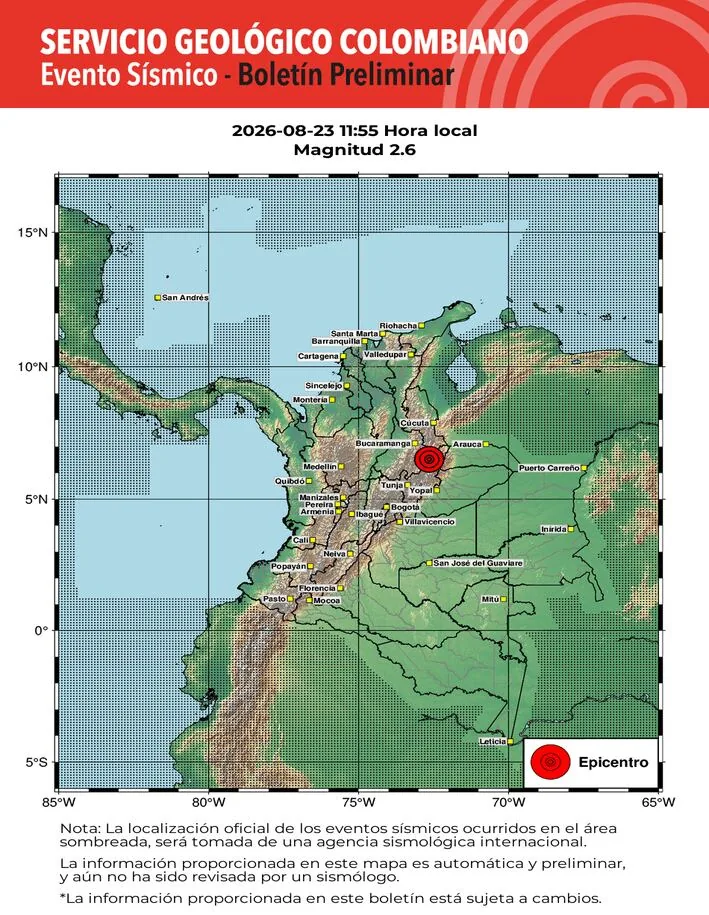
- Earthquake in Aratoca – Santander
- Date and Local Time: 2026-08-23 11:55
- Magnitude: 2.6
- Depth: 147 km
- Latitude: 6.70
- Longitude: -73.00
- WHY SHOULD YOU NEVER USE AN ELEVATOR DURING AN EARTHQUAKE?
Experts recommend never using the elevator during an earthquake or tremor, as it could detach from its structure and fall from a great height with people inside.
Information about the earthquake in Cucunubá – Cundinamarca, Colombia reported at 9:04 local time.
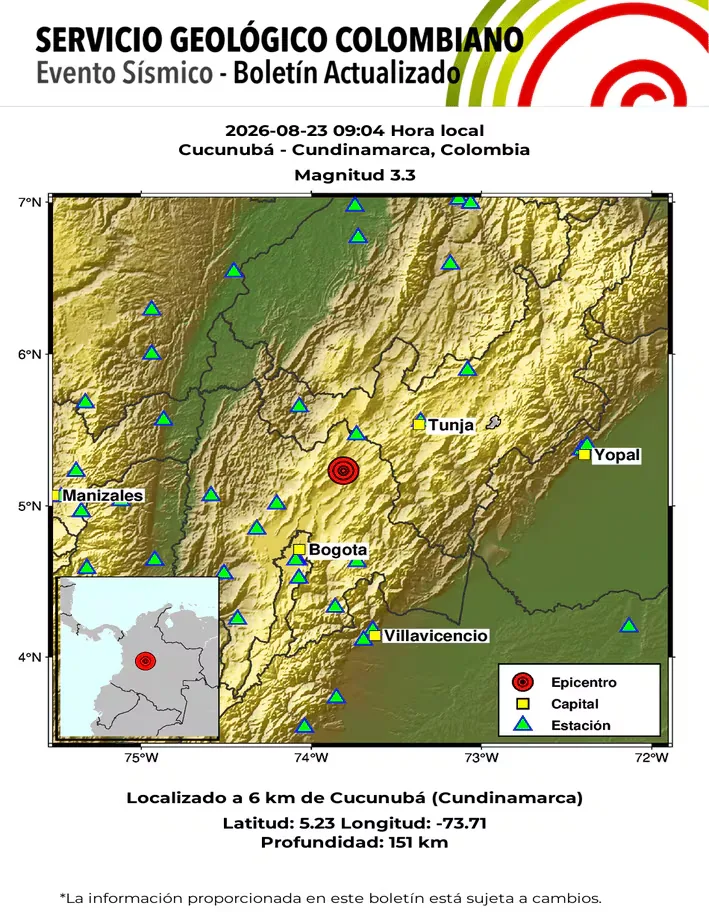
- What to do before, during, and after an earthquake?
Preparation is one of the main tools to reduce the risks associated with earthquakes.
- Before an earthquake
- Prepare an emergency backpack with water, food, flashlight, first aid kit, and basic items.
- Develop a family plan and establish meeting points.
- Secure furniture, shelves, and heavy objects that could fall.
- Identify safe places inside your home, office, or educational center.
- Check evacuation routes and know the available exits.
- During an earthquake
- The main recommendation is to crouch, cover, and hold on.
- If you are inside a building, seek protection under a sturdy table and protect your head and neck. Stay away from windows, glass, shelves, and objects that could fall.
- Do not run towards the exit while the shaking continues and avoid using elevators.
- If you are on the street, stay away from buildings, poles, wires, and other elements that could fall. If you are driving, stop in a safe place and stay inside the vehicle until the shaking stops.
- After an earthquake
- Check if there are injured people and inspect possible damages only when it is safe to do so.
- Pay attention to gas leaks, electrical damage, or structural problems. Avoid entering affected buildings until they have been inspected and deemed safe by authorities.
- Stay informed through official channels of the SGC and risk management entities.
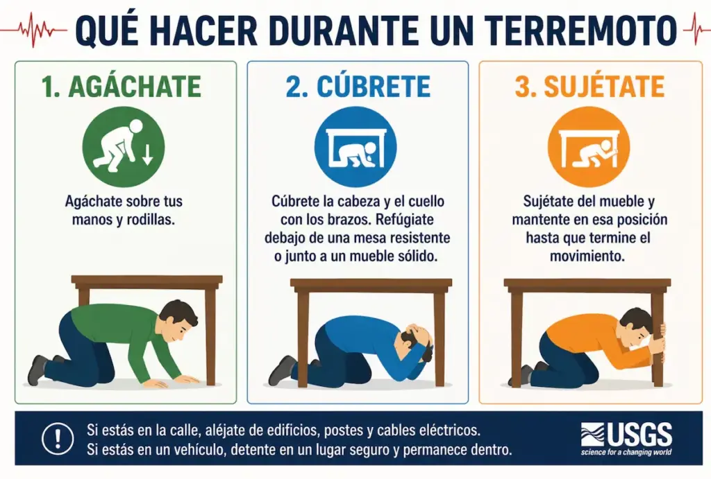
- Earthquake in Cucunubá – Cundinamarca, Colombia
- Magnitude: 3.3
- Depth: 151 km
- Local time: 2026-08-23 09:04:55
- UTC time: 2026-08-23 14:04:55
- Latitude: 5.23°
- Longitude:-73.71°
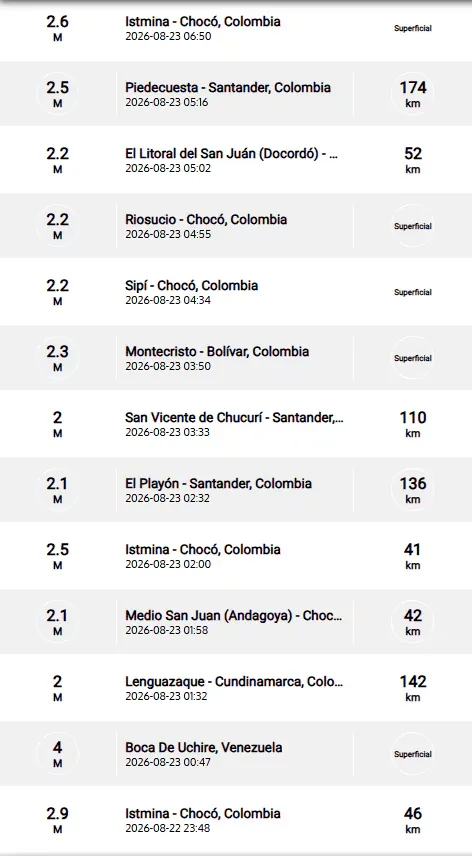
- UPDATED EARTHQUAKE REPORTS:
WHAT IS THE DIFFERENCE BETWEEN EARTHQUAKE, TREMOR, SEISM, AND TELURIC MOVEMENT?
Actually, the four terms are synonyms, but in Latin America special emphasis has been given to the term earthquake to refer to destructive earthquakes or those that have caused victims.
HOW MANY SEISMOGRAPHS ARE THERE?
NATIONAL SEISMOLOGICAL NETWORK OF COLOMBIA-RSNC
The SGC has a total of 339 seismic stations, located throughout the Colombian territory and in specific areas such as active volcanoes. 206 seismic stations are located covering the entire territory corresponding to the National Seismic Network.
There are 133 seismic stations installed on the active Colombian volcanoes that are permanently monitored in three volcanological and seismological observatories.
WHAT IS THE COLOMBIAN GEOLOGICAL SERVICE?
The SGC is a century-old science and technology entity attached to the Ministry of Mines and Energy, whose objective is to contribute to the economic and social development of the country, through research in basic and applied geosciences of the subsurface, the potential of its resources, the evaluation and monitoring of geological hazards, the comprehensive management of geoscientific knowledge, research and nuclear and radioactive control, attending to the priorities of the National Government’s policies.
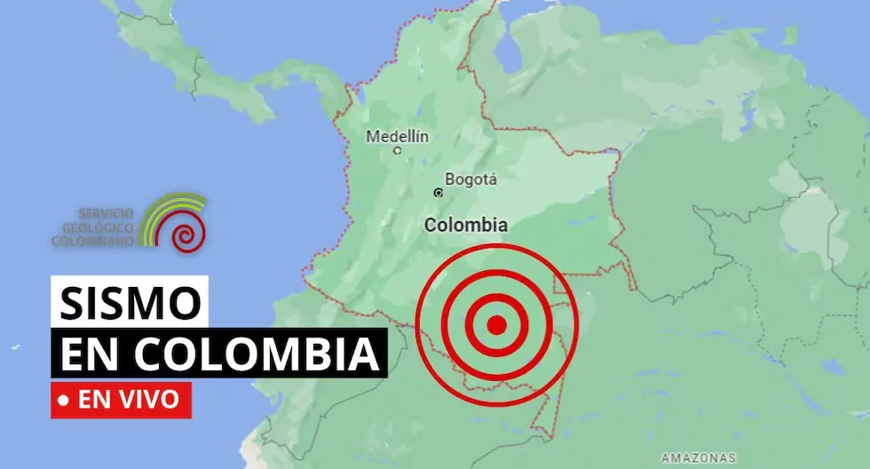
What was the magnitude and where was the last tremor? See here the reports from the Colombian Geological Service (SGC) about the latest earthquakes in the country.