![Alberto Beingolea: “If they insist on not giving [the powers], they are complicating life for Peru”](https://insightermedia.com/wp-content/uploads/2026/09/bb3fa9e11304ea13fe2cd333955007bc-150x150.webp "Alberto Beingolea: “If they insist on not giving [the powers], they are complicating life for Peru”")



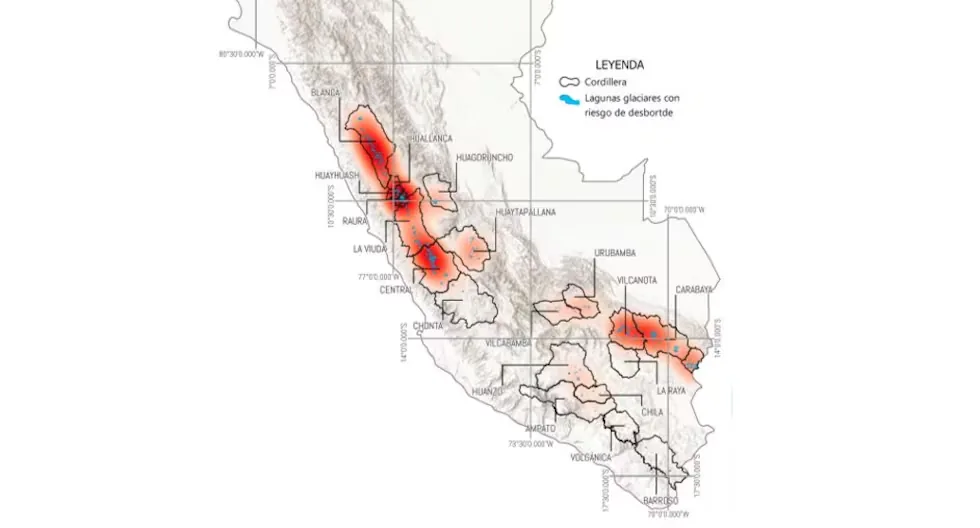
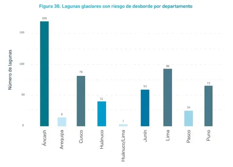
Of these, 58 were classified as very high risk and 20 appear among those with the highest values in the study. The assessment, published in December 2024, does not mean that the 528 lagoons are about to overflow. The study establishes different risk levels — low, medium, high, and very high — based on variables related to the susceptibility of the lagoon and the exposure of the population. Of the 528, 336 present low risk, 43 medium risk, 91 high risk, and 58 very high risk.
Read more 1926: Visit of Spanish footballers to Lima
The problem, however, is that glacier systems are dynamic. The retreat of glaciers favors the formation and growth of lagoons, while factors such as heavy rains, high temperatures, rock or ice falls, and, in some cases, earthquakes can contribute to creating conditions for a violent overflow. The INAIGEM itself warns that climate change is accelerating glacier retreat and the growth of these lagoons.
Upiscocha tops the ranking: a lagoon that has already overflowed
The lagoon that ranks first among the 20 highest risk ones is Upiscocha, in the Vilcanota mountain range, Cusco. The study assigned it a risk index of 0.99, the highest value in the national assessment. Its high susceptibility is related to its steep slopes, proximity to glaciers, and the presence of areas capable of generating rockfalls and landslides.
This is not a merely hypothetical danger. On August 9, 2022, falling rocks caused the overflow of Upiscocha. The study also notes that the lagoon experienced two GLOF events — glacial lake outburst floods — during that year. It currently has a recorded volume of about 17.86 million cubic meters and there are approximately 111 homes exposed downstream, in towns such as Yanama, Ocongate, and Ccarhuayo.
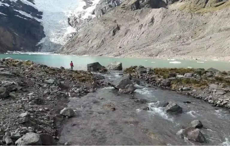
Paola Moschella, director of the Glacier Research Directorate at INAIGEM, explains that Upiscocha remains one of the main focal points. “It has shown a very significant increase in the last decade”, she said, referring to the growth of the lagoon as the glacier retreats.
But the ranking also shows that the danger does not depend solely on how susceptible a lagoon is to overflowing. In some cases, the determining factor is the number of people or homes located downstream.
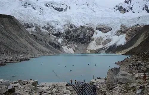
That is why Palcacocha, in Áncash, ranks second despite having lower susceptibility than Upiscocha, since its level of exposure is much higher.
Huancayo, Caraz, and other cities also appear on the map
The risk is not concentrated only in Áncash. The assessment identified 53 lagoons at risk of overflow in Junín, of which five have very high risk. Among them is Pumacocha, which presents the highest risk within the department due to its susceptibility. But the case that raises the most concern due to exposure is Lazo Huntay, in the Huaytapallana mountain range. The study estimates 5,829 homes exposed and identifies it as a threat to the city of Huancayo.
In Cusco, besides Upiscocha, Auzangatecocha, Qolque Punku Bajo, Alccachayacocha, Yanaloma, and Marampaqui, among others, appear among the 20 lagoons with the highest national risk. Auzangatecocha, for example, has an estimated 1,647 homes exposed.
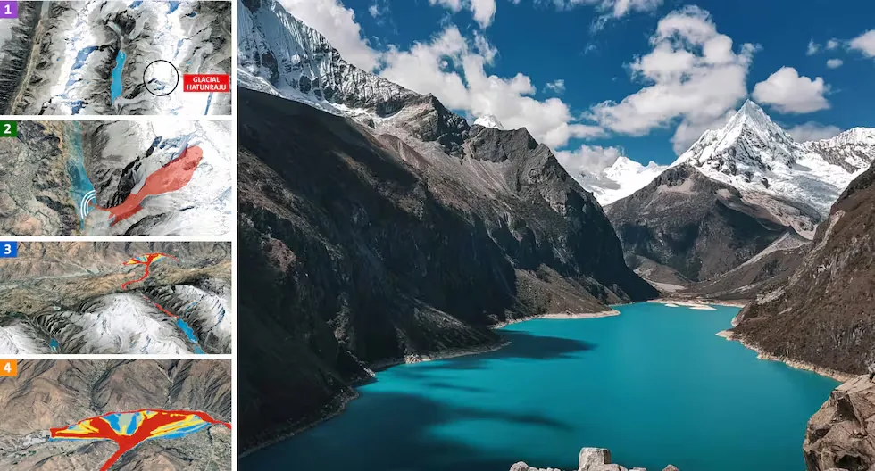
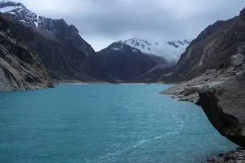
Another case is Parón, in the Callejón de Huaylas. It ranks seventh in the national ranking, with a risk index of 0.59 and about 545 homes exposed according to the 2024 assessment. Moschella identifies it as another priority case due to its large size and the population that could be exposed in Caraz.
In Huánuco, Gangrajanca appears in 15th place and is also part of the group of lagoons currently monitored with real-time sensors. In Lima, the highest risk case is Rurigallay, in the Pativilca river basin, which ranks 18th nationally and has about 141 homes exposed.
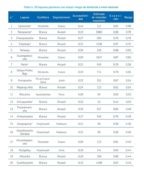
In total, more than half of the 20 lagoons with the highest risk are in Áncash and one fifth in Cusco. Three of them represent a threat to Huaraz, namely Palcacocha, Tullparaju, and Cuchillacocha.
The risk changes, but the country still lacks a new national ranking
There is a key detail to understand the current situation. The assessment of 528 lagoons corresponds to 2024 and INAIGEM has not yet conducted a national update to determine how many of them maintain, have increased, or have reduced their risk level.
Moschella explained that the institution needs to gather new data, including information on lagoon volumes and smaller water bodies that were not considered in the first assessment. “We still do not have a national update,” she indicated.

That does not mean the work has stopped. Since 2024, INAIGEM has developed more detailed studies in prioritized cases in Áncash, Huánuco, Junín, and Cusco. These studies incorporate field information and specialized modeling to determine how a possible flood would behave and which areas could be affected. The results become hazard maps that are delivered to regional and local governments.
Three lagoons already have real-time monitoring, but the alert depends on authorities
One of the advances after the study is the creation of the National Center for Glacier and Mountain Ecosystem Monitoring. From there, INAIGEM currently monitors with cameras and sensors, in real time, three highest-risk lagoons, these being the lagoons Upiscocha in Cusco, Palcacocha in Huaraz, and Gangrajanca in Huánuco.
The institution collects information on the behavior of these water bodies and can generate automated alerts when certain parameters exceed established thresholds. However, there is an important difference between monitoring and directly alerting the population, since local governments are responsible for implementing alert systems for possible evacuation.
For Moschella, expanding these systems should be a priority. In the highest risk cases, an early warning system could provide “15, 20 or more minutes” for the population to move to safe areas.
The 2024 study itself recommended implementing monitoring and early warning systems, defining safe water levels, signposting evacuation routes, evaluating and rehabilitating safety works, and strengthening the capacities of exposed institutions and communities.
An alert is not enough if the population does not know where to evacuate
For Luis Morán Yáñez, president of the National Risk and Disaster Management Commission of the College of Engineers of Peru and professor of Civil Engineering at the National University of San Marcos, the response must advance on two fronts, engineering and community preparedness.
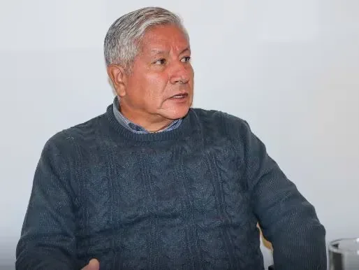
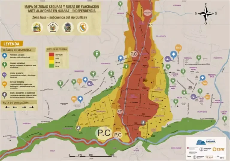
The specialist considers that populations located downstream of the most dangerous lagoons should have, at a minimum, evacuation maps, community early warning systems, drills, and monitoring of high mountain areas. The exercises, he argues, should include nighttime scenarios to approximate the real conditions of an emergency.
His proposal is based on the idea that it will not always be possible to immediately relocate exposed populations. Therefore, while that exposure is reduced, it is necessary to increase their response capacity. “Evacuation maps, I believe, are the minimum that should be available by region,” Morán said.
He also suggests that local and regional governments work with specialists to determine which lagoons require physical interventions. Among the alternatives, he mentions controlled water release when technical conditions allow, maintenance or reinforcement of dikes, and prohibition of new settlements in mudflow or flood channels.
Works built decades ago face new conditions
The aging of safety works is another identified problem. The 2024 study already recommended evaluating, improving, or rehabilitating existing structures.
Moschella explains that some of these works were built when the lagoons were smaller. With the growth of the water bodies, the conditions for which they were designed have changed. Added to this is the wear caused by lack of maintenance in certain cases.
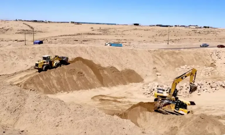
Morán agrees that a dike, wall — artificial or natural — designed to contain, regulate, or divert water flow and protect vulnerable areas against flooding, must be reevaluated under current conditions. If a structure cannot be reinforced, he suggests studying controlled release alternatives to avoid dangerous water accumulation.
The problem is also budgetary. INAIGEM does not have a national estimate of how much it would cost to intervene in all priority lagoons. Moschella points out that a safety work can be costly to address a single water body, while there are several dozen that require attention. Therefore, the institution proposes expanding monitoring as a way to cover more critical points and have sensors even at the basin level.
The danger is not only in the lagoons: Huascarán puts Yungay back in the spotlight
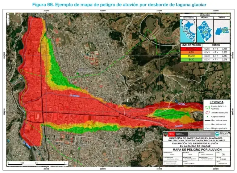
The case of Nepal also forces a broader view. A glacier-origin event does not necessarily start with the overflow of a lagoon. INAIGEM has been monitoring critical zones of the Huascarán snow peak and has created hazard maps on possible rockfalls that could generate a new flood.
Moschella points out that there are zones of greater instability in the northern and southern sectors of Huascarán and that modeling allows identifying areas that could be affected by a possible flood. “We also have here the risk of avalanches from the Huascarán snow peak,” she explained.
The precedent is Yungay, in 1970, when a rockfall from Huascarán, triggered in the context of the May 31 earthquake, generated a flood that buried the city. Juan Manuel Arribas, founder and executive director of Hombro a Hombro, warns that preparation for an event of this nature cannot be limited to installing an alarm.
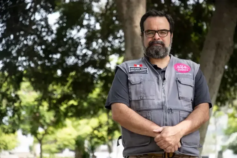
Arribas has drawn attention to a scenario associated with the southern wall of Huascarán and a massif that, according to the technical report he referenced during his interview with El Comercio, would involve a volume considerably larger than the rockfall that caused the 1970 disaster.
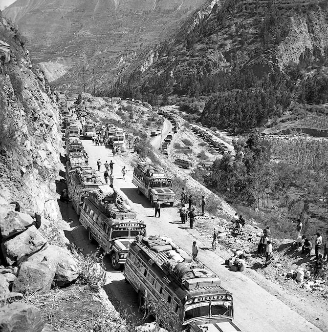
What is established by INAIGEM is that glacial rockfalls constitute a danger that must be monitored and modeled. The national study also points out that, besides lagoon conditions, slopes, fractures, and rock characteristics can favor rockfalls capable of generating overflows or floods.
Nepal: knowing the risk before the disaster arrives
The three experts consulted by El Comercio agree in saying that, after identifying dangerous lagoons, the challenge is to turn that information into effective prevention for those living downstream.
For Morán, the criterion to prioritize interventions should combine the level of danger with the number of exposed people. Arribas, from humanitarian management, insists that an alert will only be effective if the population knows how to respond. And Moschella proposes expanding monitoring, detailed studies, and early warning systems.
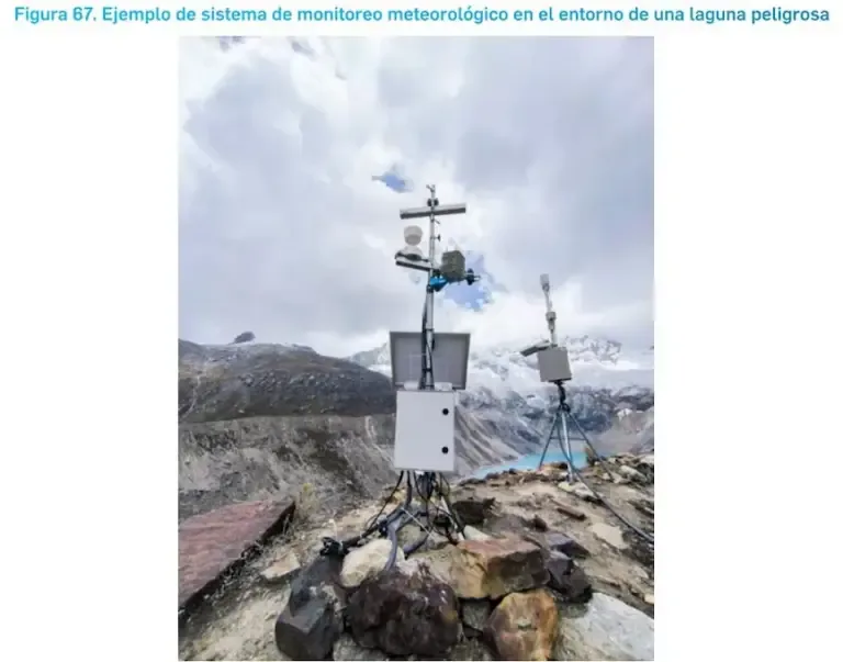
The INAIGEM study already proposed that roadmap in 2024 with specialized studies for the most dangerous lagoons, safe water levels, monitoring, evacuation routes, safety works, early warning, and urban planning to prevent new populations from occupying very high-risk areas.
The warning from Nepal, then, does not imply that a similar tragedy will happen tomorrow in Peru, but it does expose again that the country has identified the points where the risk is highest, but still faces the challenge of turning that scientific knowledge into alert systems, evacuation, works, and planning capable of protecting exposed populations.
- Justice Ministry Commission begins comprehensive review of laws against crime
- President of Colombia confirms capture of leader of the ‘Tren de Aragua’ in Peru
- Prosecutor’s Office concludes preparatory investigation in Anguía Case: What facts are attributed to Yenifer Paredes?